|
search place name
|
||
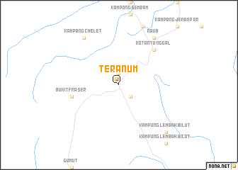
Teranum (Pahang, Malaysia)Teranum is a town in the Pahang region of Malaysia. An overview map of the region around Teranum is displayed below.
regional and 3d topo map of Teranum, Malaysia ::
Teranum airports ::
The nearest airport is KUL - Kuala Lumpur Intl, located 109.9 km south of Teranum.
Other airports nearby include IPH - Ipoh Sultan Azlan Shah (122.4 km north west), KUA - Kuantan (154.7 km east), MKZ - Malacca (169.6 km south), KTE - Kerteh (199.7 km north east), Nearby towns ::
Teras (1.9km north) //
Kampong Sungai Chendarawi (2.6km south east) //
Bukit Fraser (7.6km west) //
Kampong Sempalit Ulu (7.9km north east) //
Rotan Tunggal (7.9km north east) //
Kampong Chelet (9.3km north west) //
Raub (9.3km north east) //
Kampong Sempalit Hilir (9.3km north east) //
Kampung Lembah Bilut (10.5km south east) //
[all distances 'as the bird flies' and approximate] 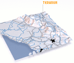 Places with similar names to Teranum, Malaysia ::
// Tarinam (MM)
// Dornum (DE)
// Tornimäe (EE)
// Darnīām (IR)
// Turinuma (EC)
// Tarua-anim (ID)
// Tarnamo (GH)
// Darou Naïm (SN)
// Darou Nem (SN)
// Drenomi (PK)
Disclaimer :: Information on this page comes without warranty of any kind |
||
|
Where is Teranum? Elevation and coordinates ::
Latitude (lat): 3°44'0"N Longitude (lon): 101°49'0"E
Elevation (approx.): 338m (map arrows pan, magnifying glasses zoom) |
||
|
Visiting Teranum? Hotel/Accommodation ::
Book a hotel in Teranum Travel Guide ::
Buy a travel guide for Malaysia rental cars ::
car rental offers GPS waypoint ::
download a GPX waypoint (PoI) of Teranum for your GPS receiver
|
||