|
search place name
|
||
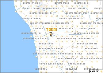
Tokai (Kedah, Malaysia)Tokai is a town in the Kedah region of Malaysia. An overview map of the region around Tokai is displayed below.
regional and 3d topo map of Tokai, Malaysia ::
Tokai airports ::
The nearest airport is AOR - Alor Setar Sultan Abdul Halim, located 19.1 km north of Tokai.
Other airports nearby include PEN - Penang Intl (80.7 km south), LGK - Pulau Langkawi Intl (82.0 km north west), HDY - Songkhla Hat Yai Intl (101.4 km north), PAN - Pattani (119.1 km north east), Nearby towns ::
Kampong Masjid Tokai (0.0km north) //
Kampong Pulai (1.8km east) //
Kampong Selarong Batang (1.8km west) //
Simpang Empat (1.8km west) //
Kampong Dua Puloh Relong (2.6km north east) //
Kampong Kepala Parit (2.6km north west) //
Kampong Benua (2.6km north west) //
Kampong Alor Tok Ya (2.6km south east) //
Kampong Senggora (2.6km south west) //
Kampong Lahar Kelambu (2.6km south west) //
Kampong Pisang (2.6km south west) //
Kampong Limabelas Relong (3.7km east) //
Kampong Tiga Puloh Relong (3.7km north) //
Kampong Selarong Panjang (3.7km west) //
Kampong Kepala Buaya (3.7km west) //
Kampong Buloh Lima (3.7km south) //
Kota Sarang Semut (3.7km south) //
Kampong Lahar Budi (4.1km north east) //
Kampong Lang Merah (4.1km south east) //
Kampong Padang Jambu (4.1km south west) //
Kampong Pulau Wan Awang (4.1km south east) //
Kampong Alor Besar (4.1km south east) //
Kampong Jawa (4.1km south west) //
Kampong Alor Serdang (4.1km south west) //
Kampong Pak Jalil (4.1km south west) //
Kampong Bokbok (5.2km north east) //
Kampong Kebun Pinang (5.2km north west) //
Kampong Kubang Anak Gajah (5.2km south east) //
Kampong Pisang (5.2km south west) //
[all distances 'as the bird flies' and approximate]  Places with similar names to Tokai, Malaysia ::
Disclaimer :: Information on this page comes without warranty of any kind |
||
|
Where is Tokai? Elevation and coordinates ::
Latitude (lat): 6°1'0"N Longitude (lon): 100°24'0"E
Elevation (approx.): 4m (map arrows pan, magnifying glasses zoom) |
||
|
Visiting Tokai? Hotel/Accommodation ::
Book a hotel in Tokai Travel Guide ::
Buy a travel guide for Malaysia rental cars ::
car rental offers GPS waypoint ::
download a GPX waypoint (PoI) of Tokai for your GPS receiver
|
||