|
search place name
|
||
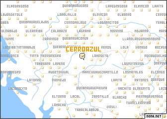
Cerro Azul (Veraguas, Panama)Cerro Azul is a town in the Veraguas region of Panama. An overview map of the region around Cerro Azul is displayed below.
regional and 3d topo map of Cerro Azul, Panama ::
Cerro Azul airports ::
The nearest airport is DAV - David Enrique Malek Intl, located 103.3 km west of Cerro Azul.
Other airports nearby include BOC - Bocas Del Toro Intl (159.0 km north west), OTR - Coto 47 (166.4 km west), CHX - Changuinola Cap Manuel Nino Intl (185.6 km north west), GLF - Golfito (190.3 km west), Nearby towns ::
Viralito (1.9km south) //
La Sabaneta (1.9km north) //
Boca La Marta (1.8km east) //
Salitre (2.6km south west) //
El Macho (2.6km north west) //
Conga (2.6km north west) //
La Meseta (3.7km east) //
Cabecera de Pilones (3.7km north) //
Cerro de Casa (3.7km north) //
Galápago (3.7km north) //
La Marta (4.1km north east) //
Los Potreros (4.1km north east) //
El Barrero (4.1km north east) //
Jorones Arriba (4.1km south east) //
Jorones (4.1km south west) //
Manicudá de Jorones (4.1km south east) //
Cerro Mono (4.1km south west) //
Platanares (4.1km south west) //
Quebrada Grande (4.1km north west) //
El Galgo (4.1km north west) //
Cerro Gato (4.1km north east) //
Quebrada Conga (4.1km north west) //
Manicudá de Zapotillo (5.2km south east) //
Chibrital (5.2km north west) //
La Grama (5.6km north) //
Peña Blanca Abajo (5.8km west) //
La Peña (5.8km west) //
Carrizo (5.8km west) //
Alto de la Arena (5.8km west) //
[all distances 'as the bird flies' and approximate] 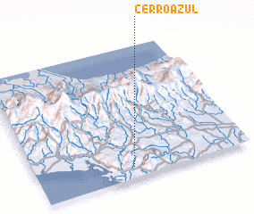 Places with similar names to Cerro Azul, Panama ::
// Şorsulu (AZ)
// Şorsulu (AZ)
// Xoruzlu (AZ)
// Zarıslı (AZ)
// Sarcillo (US)
// Cerrezuela (PA)
// Cerro Azul (PA)
// Cerasola (IT)
// Cerasolo (IT)
// Cerasuolo (IT)
Disclaimer :: Information on this page comes without warranty of any kind |
||
|
Where is Cerro Azul? Elevation and coordinates ::
Latitude (lat): 8°5'0"N Longitude (lon): 81°33'0"W
Elevation (approx.): 151m (map arrows pan, magnifying glasses zoom) |
||
|
Visiting Cerro Azul? Hotel/Accommodation ::
Book a hotel in Cerro Azul Travel Guide ::
Buy a travel guide for Panama rental cars ::
car rental offers GPS waypoint ::
download a GPX waypoint (PoI) of Cerro Azul for your GPS receiver
|
||