|
search place name
|
||
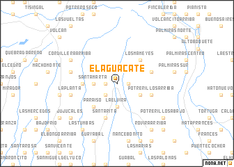
El Aguacate (Chiriquí, Panama)El Aguacate is a town in the Chiriquí region of Panama. An overview map of the region around El Aguacate is displayed below.
regional and 3d topo map of El Aguacate, Panama ::
El Aguacate airports ::
The nearest airport is DAV - David Enrique Malek Intl, located 36.4 km south of El Aguacate.
Other airports nearby include OTR - Coto 47 (47.3 km west), GLF - Golfito (69.6 km west), BOC - Bocas Del Toro Intl (78.1 km north east), CHX - Changuinola Cap Manuel Nino Intl (84.0 km north), Nearby towns ::
Las Monjas (1.8km west) //
Palmira del Banco (1.8km east) //
Palma Real (2.6km south west) //
La Elvira (3.7km south) //
Santa Marta (3.7km west) //
El Banco (4.1km south east) //
Los Mameyes (5.2km north east) //
Paraíso (5.2km south west) //
Cordillera Abajo (5.5km west) //
Potrerillos Arriba (5.8km east) //
Cabecera de Cochea (5.8km east) //
Brazo de Cochea (5.8km east) //
Santa Rita (5.9km south) //
La Planta (7.6km west) //
Bijao (7.6km west) //
Cordillera Arriba (8.2km north west) //
Las Tumbas (9.2km south west) //
Rovira Arriba (9.2km south east) //
Jujucales (9.2km south west) //
Potrerillos Abajo (9.2km south east) //
Rovira Abajo (10.4km south east) //
[all distances 'as the bird flies' and approximate] 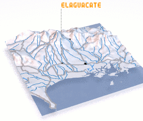 Places with similar names to El Aguacate, Panama ::
// El Ougagda (MA)
// El Aguacate (PA)
// El Aguacate (PA)
// El Aguacate (PA)
// El Aguacate (PA)
// El Cacaíto (PA)
// El Coquito (PA)
// El Coquito (PA)
// El Aguacate (CU)
// El Aguacate (CU)
Disclaimer :: Information on this page comes without warranty of any kind |
||
|
Where is El Aguacate? Elevation and coordinates ::
Latitude (lat): 8°42'0"N Longitude (lon): 82°33'0"W
Elevation (approx.): 1097m (map arrows pan, magnifying glasses zoom) |
||
|
Visiting El Aguacate? Hotel/Accommodation ::
Book a hotel in El Aguacate Travel Guide ::
Buy a travel guide for Panama rental cars ::
car rental offers GPS waypoint ::
download a GPX waypoint (PoI) of El Aguacate for your GPS receiver
|
||