|
search place name
|
||
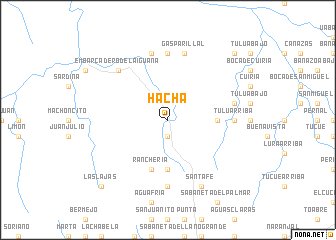
Hacha (Coclé, Panama)Hacha is a town in the Coclé region of Panama. An overview map of the region around Hacha is displayed below.
regional and 3d topo map of Hacha, Panama ::
Hacha airports ::
The nearest airport is HOW - Howard, located 96.8 km east of Hacha.
Other airports nearby include PAC - Panama Marcos A Gelabert Intl (102.8 km east), PTY - Panama City Tocumen Intl (123.8 km east), BOC - Bocas Del Toro Intl (206.2 km west), DAV - David Enrique Malek Intl (220.6 km west), Nearby towns ::
Las Dueñas (1.9km south) //
Cascajal (5.6km south) //
La Tulua (5.5km east) //
Ranchería (5.9km south) //
Canoa Número Dos (7.4km north) //
Tulú Arriba (7.3km east) //
El Santísimo (7.4km south) //
Boca de Cutevilla (7.6km north) //
Gasparillal (7.6km north) //
Lubré (7.6km east) //
Embarcadero de la Iguana (7.8km north west) //
Santa Fe (8.3km south east) //
Las Lajas (10.4km south west) //
Gato Espino (10.4km north east) //
[all distances 'as the bird flies' and approximate] 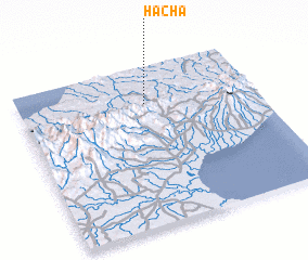 Places with similar names to Hacha, Panama ::
Disclaimer :: Information on this page comes without warranty of any kind |
||
|
Where is Hacha? Elevation and coordinates ::
Latitude (lat): 8°46'0"N Longitude (lon): 80°28'0"W
Elevation (approx.): 159m (map arrows pan, magnifying glasses zoom) |
||
|
Visiting Hacha? Hotel/Accommodation ::
Book a hotel in Hacha Travel Guide ::
Buy a travel guide for Panama rental cars ::
car rental offers GPS waypoint ::
download a GPX waypoint (PoI) of Hacha for your GPS receiver
|
||