|
search place name
|
||
La Úrsula (Colón, Panama)La Úrsula is a town in the Colón region of Panama. An overview map of the region around La Úrsula is displayed below.
regional and 3d topo map of La Úrsula, Panama ::

La Úrsula airports ::
The nearest airport is HOW - Howard, located 76.0 km east of La Úrsula.
Other airports nearby include PAC - Panama Marcos A Gelabert Intl (80.2 km east), PTY - Panama City Tocumen Intl (99.1 km east), BOC - Bocas Del Toro Intl (219.2 km west), Nearby towns ::
Caño Claro (1.8km east) //
Tahuita (4.1km north west) //
Berolizar (5.2km north west) //
Mata Palo (5.9km south) //
La Boca del Guásimo (6.6km north west) //
Tres Brazos (6.8km south east) //
El Fardal (7.6km south east) //
El Papayo (7.7km south east) //
Aguacate (7.9km east) //
Cerro Miguel (9.2km south east) //
Los Espaveses (9.2km north east) //
El Jobo (9.9km south east) //
Las Tres Bocas (10.4km north east) //
Las Quebradas (11.4km south east) //
[all distances 'as the bird flies' and approximate] 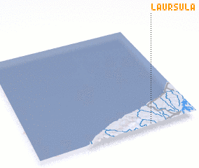 Places with similar names to La Úrsula, Panama ::
// Lourisela (PT)
// Lourizela (PT)
// La Rosalía (CU)
// La Rosalía (CU)
// La Rosalía (CU)
// La Rociella (ES)
// La Russell (US)
// Larisula (TP)
// Larisula (TP)
// Larisula (TP)
Disclaimer :: Information on this page comes without warranty of any kind |
||
|
Where is La Úrsula? Elevation and coordinates ::
Latitude (lat): 9°1'0"N Longitude (lon): 80°17'0"W
Elevation (approx.): 39m (map arrows pan, magnifying glasses zoom) |
||
|
Visiting La Úrsula? Hotel/Accommodation ::
Book a hotel in La Úrsula Travel Guide ::
Buy a travel guide for Panama rental cars ::
car rental offers GPS waypoint ::
download a GPX waypoint (PoI) of La Úrsula for your GPS receiver
|
||