|
search place name
|
||
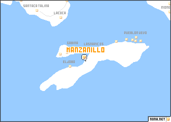
Manzanillo (Veraguas, Panama)Manzanillo is a town in the Veraguas region of Panama. An overview map of the region around Manzanillo is displayed below.
regional and 3d topo map of Manzanillo, Panama ::
Manzanillo airports ::
The nearest airport is DAV - David Enrique Malek Intl, located 168.8 km north west of Manzanillo.
Other airports nearby include HOW - Howard (230.3 km north east), OTR - Coto 47 (230.9 km north west), BOC - Bocas Del Toro Intl (232.5 km north west), PAC - Panama Marcos A Gelabert Intl (238.2 km north east), Nearby towns ::
Las Narices (3.3km north east) //
La Punta (3.4km north west) //
El Jobo (3.6km west) //
Gabina (3.9km north west) //
La Bucería (4.5km north west) //
Calabacito (5.7km west) //
Los Almácigos (8.0km north east) //
[all distances 'as the bird flies' and approximate]  Places with similar names to Manzanillo, Panama ::
// Manzanilla (PH)
// Manzanola (US)
// Manzanillo (PA)
// Manzinello (IT)
// Mensanello (IT)
// Manzanilla (ES)
// Manzanillo (ES)
// Manzanillo (ES)
// Manzanal (CO)
// Manzanillo (CO)
Disclaimer :: Information on this page comes without warranty of any kind |
||
|
Where is Manzanillo? Elevation and coordinates ::
Latitude (lat): 7°32'12"N Longitude (lon): 81°10'0"W
Elevation (approx.): 16m (map arrows pan, magnifying glasses zoom) |
||
|
Visiting Manzanillo? Hotel/Accommodation ::
Book a hotel in Manzanillo Travel Guide ::
Buy a travel guide for Panama rental cars ::
car rental offers GPS waypoint ::
download a GPX waypoint (PoI) of Manzanillo for your GPS receiver
|
||