|
search place name
|
||
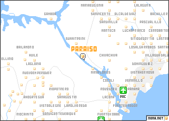
Paraíso (Panamá, Panama)Paraíso is a town in the Panamá region of Panama. An overview map of the region around Paraíso is displayed below.
regional and 3d topo map of Paraíso, Panama ::
Paraíso airports ::
The nearest airport is PAC - Panama Marcos A Gelabert Intl, located 10.8 km south east of Paraíso.
Other airports nearby include HOW - Howard (13.6 km south), PTY - Panama City Tocumen Intl (27.8 km east), Nearby towns ::
Pedro Miguel (2.6km south east) //
Summit Park (4.1km north west) //
Miraflores (5.2km south east) //
Chiva Chiva (5.5km east) //
Manteca (7.8km north east) //
Cocolí (7.8km south east) //
Pozo Hondo (8.3km south west) //
Mocambo Arriba (8.2km north east) //
Las Lajas (9.2km south west) //
Río Potrero (9.2km south west) //
Rousseau (9.2km south east) //
Corozal (9.2km south east) //
Los Ríos (9.2km south east) //
Sardinilla (9.2km north east) //
Palo Diferente (9.2km south west) //
Diablo Heights (10.4km south east) //
Albrook (10.4km south east) //
[all distances 'as the bird flies' and approximate] 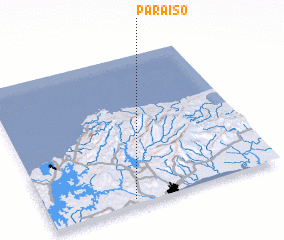 Places with similar names to Paraíso, Panama ::
Disclaimer :: Information on this page comes without warranty of any kind |
||
|
Where is Paraíso? Elevation and coordinates ::
Latitude (lat): 9°2'0"N Longitude (lon): 79°38'0"W
Elevation (approx.): 60m (map arrows pan, magnifying glasses zoom) |
||
|
Visiting Paraíso? Hotel/Accommodation ::
Book a hotel in Paraíso Travel Guide ::
Buy a travel guide for Panama rental cars ::
car rental offers GPS waypoint ::
download a GPX waypoint (PoI) of Paraíso for your GPS receiver
|
||