|
search place name
|
||
‘Abbās aş Şaddām (Al Qādisīyah, Iraq)‘Abbās aş Şaddām is a town in the Al Qādisīyah region of Iraq. An overview map of the region around ‘Abbās aş Şaddām is displayed below.
regional and 3d topo map of ‘Abbās aş Şaddām, Iraq ::

Nearby towns ::
Ghazāl Warrah (1.3km south) //
Ḩājj Salmān (3.4km south east) //
‘Afak (4.0km north west) //
Al Ḩamzah (4.8km north) //
As Sayyid Ghāzī (4.7km north east) //
Arshībah (4.9km west) //
‘Abd al Karīm (5.6km north east) //
Sacham Lurya (7.2km north west) //
‘Abbās (7.5km north) //
Al ‘Ajrān (7.7km north) //
As Sayyid Mūsá (7.1km north east) //
Farḩān (7.8km north east) //
Dhāhī al Makūtar (9.2km north east) //
[all distances 'as the bird flies' and approximate] 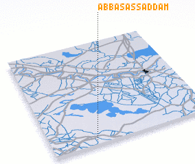 Places with similar names to ‘Abbās aş Şaddām, Iraq :: Disclaimer :: Information on this page comes without warranty of any kind |
||
|
Where is ‘Abbās aş Şaddām? Elevation and coordinates ::
Latitude (lat): 32°2'27"N Longitude (lon): 45°16'38"E
Elevation (approx.): 25m (map arrows pan, magnifying glasses zoom) |
||
|
Visiting ‘Abbās aş Şaddām? Hotel/Accommodation ::
Book a hotel in ‘Abbās aş Şaddām Travel Guide ::
Buy a travel guide for Iraq rental cars ::
car rental offers GPS waypoint ::
download a GPX waypoint (PoI) of ‘Abbās aş Şaddām for your GPS receiver
|
||