|
search place name
|
||
Al ‘Anbārīyīn (Bābil, Iraq)Al ‘Anbārīyīn is a town in the Bābil region of Iraq. An overview map of the region around Al ‘Anbārīyīn is displayed below.
regional and 3d topo map of Al ‘Anbārīyīn, Iraq ::
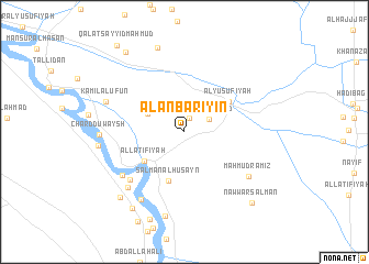
Nearby towns ::
‘Alwān Sulaymān (1.4km north) //
Mullā Fayyāḑ (2.4km north east) //
Rushdī Mullā (3.6km north west) //
Al Laţīfīyah (4.5km south west) //
Salmān al Ḩusayn (5.2km south) //
Al Yūsufīyah (4.9km north east) //
Nāyif al ‘Ajīl (6.7km south west) //
Nāyif al Huzā‘ (6.9km south west) //
Maḩmūd Rāmiz (7.1km south east) //
Yāsīn al Khuḑayr (7.4km south west) //
Qaryat Fuḩayl Umm al Khayr (7.8km south west) //
Kāmil al ‘Ufūn (7.4km north west) //
Chard Duwaysh (7.2km west) //
‘Arab ‘Alī az̧ Z̧āhir (8.7km south) //
Muḩammad aḑ Ḑāmin (7.5km west) //
Albū ‘Āmir (8.9km north) //
‘Abbās Khiḑr (8.6km south west) //
‘Abd al Karīm Faraḩ (9.0km south west) //
Nawwār Salmān (9.2km south east) //
Şāliḩ al ‘Abbūd (9.5km north west) //
Qal‘at Sayyid Maḩmūd (10.5km north west) //
[all distances 'as the bird flies' and approximate] 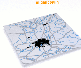 Places with similar names to Al ‘Anbārīyīn, Iraq :: Disclaimer :: Information on this page comes without warranty of any kind |
||
|
Where is Al ‘Anbārīyīn? Elevation and coordinates ::
Latitude (lat): 33°3'16"N Longitude (lon): 44°12'43"E
Elevation (approx.): 38m (map arrows pan, magnifying glasses zoom) |
||
|
Visiting Al ‘Anbārīyīn? Hotel/Accommodation ::
Book a hotel in Al ‘Anbārīyīn Travel Guide ::
Buy a travel guide for Iraq rental cars ::
car rental offers GPS waypoint ::
download a GPX waypoint (PoI) of Al ‘Anbārīyīn for your GPS receiver
|
||