|
search place name
|
||
Al Bīnakānī aş Şadr (Diyālá, Iraq)Al Bīnakānī aş Şadr is a town in the Diyālá region of Iraq. An overview map of the region around Al Bīnakānī aş Şadr is displayed below.
regional and 3d topo map of Al Bīnakānī aş Şadr, Iraq ::

Nearby towns ::
Shawk ar Rīm (1.9km north) //
Ghuziljah (1.9km north) //
Al Miqdādīyah (2.5km north west) //
Jāsim Khalīl (2.5km west) //
Al Wajīhīyah (2.8km south east) //
Sikkah (2.8km south west) //
Aḩmad Ḩammādī (4.8km north) //
Shafqarāq (4.9km north) //
Ḩasan al Jāsim (5.6km north) //
Muḩammad (5.6km north) //
Khaylānīyah (6.1km north west) //
Al Manşūrīyah (6.8km north east) //
Khalīl al Amīn (6.1km east) //
Ismā‘īl al ‘Iss (7.4km north) //
Ḩamad ‘Arab (7.2km north west) //
Khayjarān (7.7km north) //
Chichān (7.8km south) //
Ḩamādah (6.9km east) //
Dūlāb (7.8km south west) //
Al ‘Ālī (8.4km north) //
‘Arab Ḩammādah (8.2km north) //
Naqīb (7.8km north west) //
Al Mansūrīyah (8.4km north east) //
Sinsil (7.9km north west) //
Ma‘dan (8.5km north west) //
Jāsim (9.0km north west) //
[all distances 'as the bird flies' and approximate] 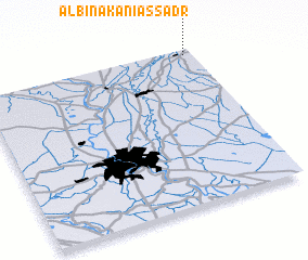 Places with similar names to Al Bīnakānī aş Şadr, Iraq :: Disclaimer :: Information on this page comes without warranty of any kind |
||
|
Where is Al Bīnakānī aş Şadr? Elevation and coordinates ::
Latitude (lat): 33°58'1"N Longitude (lon): 44°57'37"E
Elevation (approx.): 58m (map arrows pan, magnifying glasses zoom) |
||
|
Visiting Al Bīnakānī aş Şadr? Hotel/Accommodation ::
Book a hotel in Al Bīnakānī aş Şadr Travel Guide ::
Buy a travel guide for Iraq rental cars ::
car rental offers GPS waypoint ::
download a GPX waypoint (PoI) of Al Bīnakānī aş Şadr for your GPS receiver
|
||