|
search place name
|
||
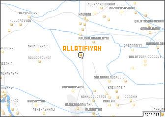
Al Laţīfīyah (Bābil, Iraq)Al Laţīfīyah is a town in the Bābil region of Iraq. An overview map of the region around Al Laţīfīyah is displayed below.
regional and 3d topo map of Al Laţīfīyah, Iraq ::
Nearby towns ::
Nāyif (2.3km north) //
Tawfīq (3.5km north east) //
Fāliḩ ‘Alī ad Dulaymī (4.3km north east) //
Qal‘at ‘Alī ad Dulaymī (5.5km north) //
Al Maḩmūdīyah (6.6km north) //
‘Umrān Ḩusayn (7.7km south) //
Ḩarīr (7.8km north) //
Sakrān (7.9km north) //
‘Arab Muḩammad al ‘Īfān (7.8km south) //
Salmān al Mudallil (7.3km south east) //
Kāz̧im as Salmān (8.8km north) //
Ni‘mah Kāz̧im (9.3km south east) //
Ḩusayn al ‘Abd Allāh (10.2km north east) //
Muḩammad (10.2km south east) //
Khuḑayr (10.2km south east) //
Kāz̧im Nāşir (10.0km south east) //
Buyūt Jarw (11.1km south east) //
[all distances 'as the bird flies' and approximate]  Places with similar names to Al Laţīfīyah, Iraq ::
// Al Laţīfīyah (IQ)
Disclaimer :: Information on this page comes without warranty of any kind |
||
|
Where is Al Laţīfīyah? Elevation and coordinates ::
Latitude (lat): 32°59'47"N Longitude (lon): 44°21'42"E
Elevation (approx.): 36m (map arrows pan, magnifying glasses zoom) |
||
|
Visiting Al Laţīfīyah? Hotel/Accommodation ::
Book a hotel in Al Laţīfīyah Travel Guide ::
Buy a travel guide for Iraq rental cars ::
car rental offers GPS waypoint ::
download a GPX waypoint (PoI) of Al Laţīfīyah for your GPS receiver
|
||