|
search place name
|
||
Al Qāhirah (Baghdād, Iraq)Al Qāhirah is a town in the Baghdād region of Iraq. An overview map of the region around Al Qāhirah is displayed below.
regional and 3d topo map of Al Qāhirah, Iraq ::

Nearby towns ::
Nazl Rashīd ‘Alī (0.5km north east) //
Nazl Ḩikmat Bayk (1.4km south) //
Muḩaysin al Ibrāhīm (1.4km south) //
Al A‘z̧amīyah (1.8km west) //
Al Wazīrīyah (2.5km south) //
Al Quds (2.7km north) //
Ash Shālikīyah (2.9km west) //
An Nīl (3.9km south) //
Nazl Salmān Afandī (4.4km north) //
Baghdād (4.5km south) //
Al Idrīsī (4.2km south east) //
Aş Şulaykh (4.3km north west) //
Bāb ash Shaykh (5.1km south) //
Sūq al Ghazl (5.1km south) //
Qāţirkhānah (5.1km south) //
‘Alāwī al Ḩillah (5.2km south) //
Al Maşlakh (5.1km north west) //
Ishbīliyah (4.9km east) //
Umm al Ghizlān (4.9km east) //
Al Kāz̧imīyah (5.6km west) //
Aş Şāliḩīyah (7.0km south) //
Al Washāsh (6.7km south west) //
‘Arab al ‘Azīz (6.4km west) //
Ar Raşāfah (7.2km south east) //
Qāsim Mullā ‘Alwān (6.7km north west) //
Az Zahrāʼ (6.5km west) //
Şāliḩ Ḩasan (7.6km north west) //
Al Karkh (8.3km south) //
Şaddām City (7.4km east) //
[all distances 'as the bird flies' and approximate] 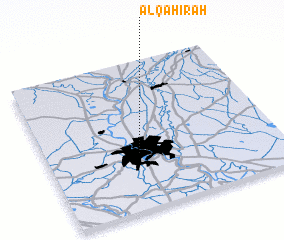 Places with similar names to Al Qāhirah, Iraq ::
// Al Khawrah (IQ)
// Al Qāhirah (IQ)
// Al Khawr (EG)
// Al Qāhir (EG)
// Āolākhair (BD)
// Alikher (IN)
// Alī Khera (IN)
// Al Khawr (SD)
// Al Khawr (SD)
// Al Khawr (QA)
Disclaimer :: Information on this page comes without warranty of any kind |
||
|
Where is Al Qāhirah? Elevation and coordinates ::
Latitude (lat): 33°22'44"N Longitude (lon): 44°23'51"E
Elevation (approx.): 39m (map arrows pan, magnifying glasses zoom) |
||
|
Visiting Al Qāhirah? Hotel/Accommodation ::
Book a hotel in Al Qāhirah Travel Guide ::
Buy a travel guide for Iraq rental cars ::
car rental offers GPS waypoint ::
download a GPX waypoint (PoI) of Al Qāhirah for your GPS receiver
|
||