|
search place name
|
||
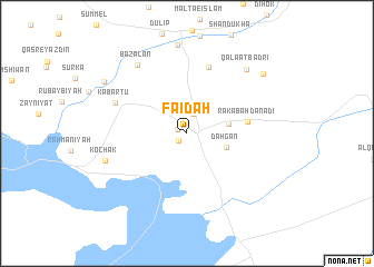
Fāʼidah (Dahūk, Iraq)Fāʼidah is a town in the Dahūk region of Iraq. An overview map of the region around Fāʼidah is displayed below.
regional and 3d topo map of Fāʼidah, Iraq ::
Fāʼidah airports ::
The nearest airport is VAN - Van, located 193.0 km north of Fāʼidah.
Other airports nearby include BAL - Batman (206.5 km north west), Nearby towns ::
Zōrafān (0.9km north west) //
Dērajindī (1.0km south west) //
Girēpān (2.0km north) //
Dahgan (3.4km south east) //
Kharshīnah (3.5km east) //
Rakabah Danadi (5.0km east) //
Zāwah (6.9km north) //
Kabartū (6.5km north west) //
Bāzalān (7.9km north west) //
Kōchak (7.1km west) //
Qalā‘at Badrī (8.0km north east) //
Ālōka (8.9km north) //
Shāriyah (8.5km north east) //
Bakhtama (8.4km north west) //
[all distances 'as the bird flies' and approximate] 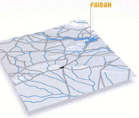 Places with similar names to Fāʼidah, Iraq ::
Disclaimer :: Information on this page comes without warranty of any kind |
||
|
Where is Fāʼidah? Elevation and coordinates ::
Latitude (lat): 36°45'33"N Longitude (lon): 42°55'42"E
Elevation (approx.): 413m (map arrows pan, magnifying glasses zoom) |
||
|
Visiting Fāʼidah? Hotel/Accommodation ::
Book a hotel in Fāʼidah Travel Guide ::
Buy a travel guide for Iraq rental cars ::
car rental offers GPS waypoint ::
download a GPX waypoint (PoI) of Fāʼidah for your GPS receiver
|
||