|
search place name
|
||
Garsūl (Arbīl, Iraq)Garsūl is a town in the Arbīl region of Iraq. An overview map of the region around Garsūl is displayed below.
regional and 3d topo map of Garsūl, Iraq ::
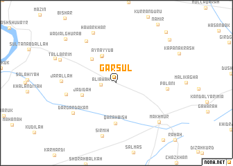
Nearby towns ::
‘Alī Āwah (2.1km west) //
Pīr Dawūd Wāsūyān (4.7km north west) //
‘Ayn Ayyūb (4.8km north west) //
Garūn al Ḩamar (5.0km north west) //
Jadīdah (4.9km south west) //
Qarah Bīsh (6.5km south) //
Palānī (6.7km east) //
Gelāshin (7.8km north west) //
Gubābah (6.8km west) //
Dār Gardakān (7.5km south west) //
Sīrmīh (8.7km south) //
Jār Allāh (7.2km west) //
Hawār Khar (8.6km north) //
Makhmūr (8.4km south east) //
Wādī al Ghurāb (9.8km north west) //
Shaykh ‘Alāf (9.8km north east) //
Bīrbirāzah (10.5km north east) //
[all distances 'as the bird flies' and approximate] 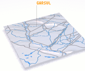 Places with similar names to Garsūl, Iraq ::
Disclaimer :: Information on this page comes without warranty of any kind |
||
|
Where is Garsūl? Elevation and coordinates ::
Latitude (lat): 35°49'59"N Longitude (lon): 43°30'56"E
Elevation (approx.): 244m (map arrows pan, magnifying glasses zoom) |
||
|
Visiting Garsūl? Hotel/Accommodation ::
Book a hotel in Garsūl Travel Guide ::
Buy a travel guide for Iraq rental cars ::
car rental offers GPS waypoint ::
download a GPX waypoint (PoI) of Garsūl for your GPS receiver
|
||