|
search place name
|
||
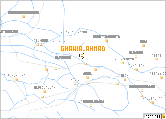
Ghāwī al Aḩmad (Al Qādisīyah, Iraq)Ghāwī al Aḩmad is a town in the Al Qādisīyah region of Iraq. An overview map of the region around Ghāwī al Aḩmad is displayed below.
regional and 3d topo map of Ghāwī al Aḩmad, Iraq ::
Nearby towns ::
Salāl Ati (1.2km south east) //
Hiyāwī al Bādī (2.7km north west) //
Farhūd Nīshān (3.3km south east) //
Jamīl (4.2km south) //
Aḩmad Shajrī (4.1km south east) //
Al Fawwār (3.9km west) //
‘Ubūd al Ḩasan (5.3km south) //
An Nabī Yūnus (5.1km north west) //
Hajīl (5.6km south) //
Jāsim al Muḩammad (5.6km north) //
Abū Yām (5.6km west) //
As Sayyid Rumayḑ (6.2km north east) //
‘Abd Allāh al Mandhūr (6.6km west) //
Ja‘ār (7.3km west) //
Arshībah (8.6km south east) //
Āl Faḑl Allāh (10.3km south west) //
[all distances 'as the bird flies' and approximate]  Places with similar names to Ghāwī al Aḩmad, Iraq :: Disclaimer :: Information on this page comes without warranty of any kind |
||
|
Where is Ghāwī al Aḩmad? Elevation and coordinates ::
Latitude (lat): 32°6'13"N Longitude (lon): 45°9'27"E
Elevation (approx.): 24m (map arrows pan, magnifying glasses zoom) |
||
|
Visiting Ghāwī al Aḩmad? Hotel/Accommodation ::
Book a hotel in Ghāwī al Aḩmad Travel Guide ::
Buy a travel guide for Iraq rental cars ::
car rental offers GPS waypoint ::
download a GPX waypoint (PoI) of Ghāwī al Aḩmad for your GPS receiver
|
||