|
search place name
|
||
Ḩājjī Bak Khān (At Taʼmīm, Iraq)Ḩājjī Bak Khān is a town in the At Taʼmīm region of Iraq. An overview map of the region around Ḩājjī Bak Khān is displayed below.
regional and 3d topo map of Ḩājjī Bak Khān, Iraq ::

Nearby towns ::
Gond-e Pāk (1.4km south west) //
Hājī Baykhān (2.7km north east) //
Raydār (3.3km north west) //
Ḩişār-ī Isrāʼīl (3.0km south west) //
Dādād (3.5km north west) //
Mard (3.3km east) //
Mard (3.3km east) //
Pāpilān (4.3km south) //
Ismā‘īl Bak (4.9km north east) //
Jēwajēwa (5.4km north) //
Julḩān (5.3km south east) //
Qūlī Bak (5.4km north west) //
‘Umar Bak (6.7km south) //
Qādir Shirrīn (5.7km east) //
Ibrāhīm Zānā (6.5km south east) //
Hisār-i Tahāʼ (6.9km west) //
Gurgān (8.0km south east) //
Gawgjah (9.1km south) //
Nibāsiyā (9.0km north) //
Qambar (7.8km south east) //
Naruja (8.7km north east) //
Tomar (8.6km south east) //
Qifār (10.2km south east) //
Wālī Pāshā (10.2km south west) //
Ḩişār Sadūn (10.5km south west) //
[all distances 'as the bird flies' and approximate] 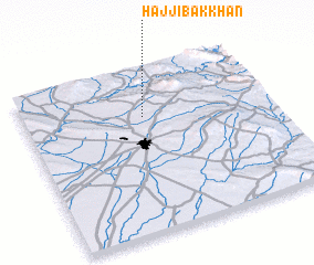 Places with similar names to Ḩājjī Bak Khān, Iraq ::
// Hājī Baykhān (IQ)
Disclaimer :: Information on this page comes without warranty of any kind |
||
|
Where is Ḩājjī Bak Khān? Elevation and coordinates ::
Latitude (lat): 35°42'29"N Longitude (lon): 44°29'7"E
Elevation (approx.): 603m (map arrows pan, magnifying glasses zoom) |
||
|
Visiting Ḩājjī Bak Khān? Hotel/Accommodation ::
Book a hotel in Ḩājjī Bak Khān Travel Guide ::
Buy a travel guide for Iraq rental cars ::
car rental offers GPS waypoint ::
download a GPX waypoint (PoI) of Ḩājjī Bak Khān for your GPS receiver
|
||