|
search place name
|
||
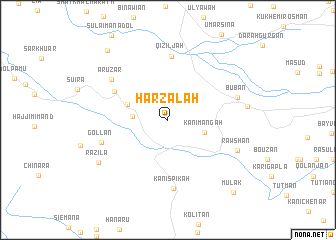
Harzalah (As Sulaymānīyah, Iraq)Harzalah is a town in the As Sulaymānīyah region of Iraq. An overview map of the region around Harzalah is displayed below.
regional and 3d topo map of Harzalah, Iraq ::
Harzalah airports ::
The nearest airport is SDG - Sanandaj, located 111.2 km east of Harzalah.
Other airports nearby include KSH - Bakhtaran Shahid Ashrafi Esfahani (182.9 km south east), Nearby towns ::
Sarkan (3.3km west) //
Kānī Mangah (3.6km south east) //
Galoz (4.1km north west) //
Dara Miana (5.8km north west) //
Qiziljah (7.1km north) //
Kānī Spīkah (7.6km south) //
Arūzār (6.8km north west) //
Gollān (6.6km south west) //
Būbān (6.8km east) //
Rawshān (7.1km south east) //
Pēnjwīn (7.4km east) //
Razila (7.9km south west) //
Badana (9.6km north west) //
Mūlāk (10.1km south east) //
[all distances 'as the bird flies' and approximate]  Places with similar names to Harzalah, Iraq ::
// Harsīlē (ER)
// Hirzel (CH)
// Hersel (DE)
// Hirzlei (DE)
// Ḩayy ar Risālah (IQ)
// Herrezuelo (ES)
// Harsail (BD)
// Harisal (IN)
// Harsauli (IN)
// Harsil (IN)
Disclaimer :: Information on this page comes without warranty of any kind |
||
|
Where is Harzalah? Elevation and coordinates ::
Latitude (lat): 35°36'23"N Longitude (lon): 45°52'2"E
Elevation (approx.): 1418m (map arrows pan, magnifying glasses zoom) |
||
|
Visiting Harzalah? Hotel/Accommodation ::
Book a hotel in Harzalah Travel Guide ::
Buy a travel guide for Iraq rental cars ::
car rental offers GPS waypoint ::
download a GPX waypoint (PoI) of Harzalah for your GPS receiver
|
||