|
search place name
|
||
Heba (At Taʼmīm, Iraq)Heba is a town in the At Taʼmīm region of Iraq. An overview map of the region around Heba is displayed below.
regional and 3d topo map of Heba, Iraq ::
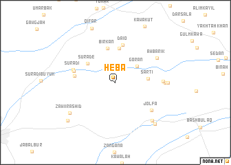
Nearby towns ::
Gorān (3.9km north east) //
Şārtī (4.3km east) //
Sūra Dē (4.8km north west) //
Dalow (5.6km north) //
Bīrkān (5.7km north) //
Daiō (6.2km north) //
Shorija (5.5km west) //
Sūrādī Būyūk (5.8km west) //
Sūra Dī (6.0km west) //
Jolfa (6.6km south east) //
Kurkī Khana (6.4km east) //
Āw Bārīk (6.8km north east) //
Gūrgāy (6.6km east) //
Gurgayi-i-Khān (6.9km east) //
Qarah Hanjīr (7.9km south east) //
Zawi-i-Rashīd (7.8km south west) //
Qarah Anjīr (8.5km south east) //
Qifār (9.3km north) //
Chamān Buyūk (8.8km south west) //
[all distances 'as the bird flies' and approximate] 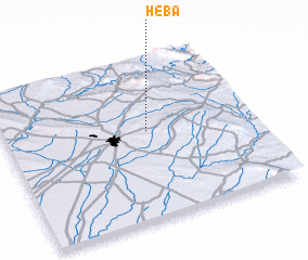 Places with similar names to Heba, Iraq ::
Disclaimer :: Information on this page comes without warranty of any kind |
||
|
Where is Heba? Elevation and coordinates ::
Latitude (lat): 35°33'0"N Longitude (lon): 44°34'39"E
Elevation (approx.): 564m (map arrows pan, magnifying glasses zoom) |
||
|
Visiting Heba? Hotel/Accommodation ::
Book a hotel in Heba Travel Guide ::
Buy a travel guide for Iraq rental cars ::
car rental offers GPS waypoint ::
download a GPX waypoint (PoI) of Heba for your GPS receiver
|
||