|
search place name
|
||
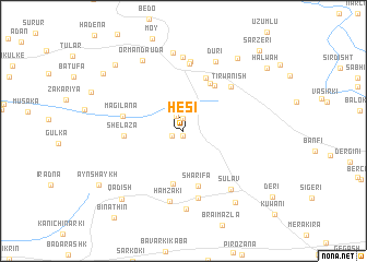
Hēsī (Dahūk, Iraq)Hēsī is a town in the Dahūk region of Iraq. An overview map of the region around Hēsī is displayed below.
regional and 3d topo map of Hēsī, Iraq ::
Hēsī airports ::
The nearest airport is VAN - Van, located 145.6 km north of Hēsī.
Nearby towns ::
Muḩammadōkē (0.5km south) //
Yakmāla (1.2km north) //
Kharāba (1.1km south west) //
Mirgajē (1.6km north) //
Bōtiya (5.5km south) //
Bishm-ē Yē (5.3km north east) //
Bētānūr (5.3km north east) //
Sharīfa (5.7km south) //
Iyēt (5.7km north) //
Shēlaza (4.9km west) //
Magilāna (5.2km west) //
Tirwanish (6.0km north east) //
Qaşr-e Yōkhanna (6.9km north) //
Bibaldi (7.0km south) //
Qaşr-e Bilbilō (7.1km north) //
Hamzaki (7.3km south) //
Kānī Māsī (7.5km north) //
Sūlav (7.2km south east) //
Dūrī (7.6km north) //
Bilichān (8.0km south) //
Darishk (8.0km north) //
Ōrmān Dāūda (7.9km north west) //
Amēdī (8.5km south east) //
Barbūrī (8.6km north east) //
Qadish (8.6km south west) //
Ōrmān (8.7km north west) //
Ravīna (8.8km north west) //
Ayn Shaykh (8.9km south west) //
Halwah (9.4km north east) //
[all distances 'as the bird flies' and approximate] 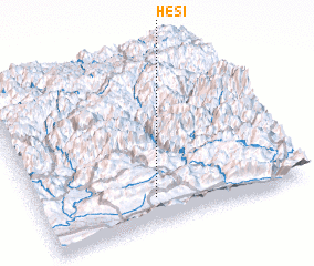 Places with similar names to Hēsī, Iraq ::
Disclaimer :: Information on this page comes without warranty of any kind |
||
|
Where is Hēsī? Elevation and coordinates ::
Latitude (lat): 37°9'33"N Longitude (lon): 43°26'22"E
Elevation (approx.): 1231m (map arrows pan, magnifying glasses zoom) |
||
|
Visiting Hēsī? Hotel/Accommodation ::
Book a hotel in Hēsī Travel Guide ::
Buy a travel guide for Iraq rental cars ::
car rental offers GPS waypoint ::
download a GPX waypoint (PoI) of Hēsī for your GPS receiver
|
||