|
search place name
|
||
Ḩusayn ash Shanober (Dhī Qār, Iraq)Ḩusayn ash Shanober is a town in the Dhī Qār region of Iraq. An overview map of the region around Ḩusayn ash Shanober is displayed below.
regional and 3d topo map of Ḩusayn ash Shanober, Iraq ::

Ḩusayn ash Shanober airports ::
The nearest airport is BSR - Basrah Intl, located 177.0 km east of Ḩusayn ash Shanober.
Nearby towns ::
‘Alī al Jūdah (1.9km south) //
Kāţi‘ Āl Ḩamad (2.2km south east) //
As Sayyid Mahdī (3.1km west) //
Kānūn as Su‘ūdī (4.8km east) //
Şabāḩ Āl Mashhad (5.8km south) //
Al Baţḩāʼ (5.6km west) //
‘Abd al Qādir (6.4km south west) //
‘Alī al Jūdah (6.6km south west) //
Ghīlān Āl ‘Anak (7.4km south) //
Āl ‘Awwād (6.6km west) //
Ghālī Āl Baţūsh (7.3km north west) //
Bachāy Āl Maţīr (7.4km south west) //
[all distances 'as the bird flies' and approximate] 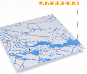 Places with similar names to Ḩusayn ash Shanober, Iraq :: Disclaimer :: Information on this page comes without warranty of any kind |
||
|
Where is Ḩusayn ash Shanober? Elevation and coordinates ::
Latitude (lat): 31°7'0"N Longitude (lon): 45°56'0"E
Elevation (approx.): 6m (map arrows pan, magnifying glasses zoom) |
||
|
Visiting Ḩusayn ash Shanober? Hotel/Accommodation ::
Book a hotel in Ḩusayn ash Shanober Travel Guide ::
Buy a travel guide for Iraq rental cars ::
car rental offers GPS waypoint ::
download a GPX waypoint (PoI) of Ḩusayn ash Shanober for your GPS receiver
|
||