|
search place name
|
||
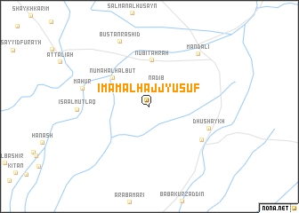
Imām al Hājj Yūsuf (Diyālá, Iraq)Imām al Hājj Yūsuf is a town in the Diyālá region of Iraq. An overview map of the region around Imām al Hājj Yūsuf is displayed below.
regional and 3d topo map of Imām al Hājj Yūsuf, Iraq ::
Imām al Hājj Yūsuf airports ::
The nearest airport is KSH - Bakhtaran Shahid Ashrafi Esfahani, located 170.6 km north east of Imām al Hājj Yūsuf.
Other airports nearby include SDG - Sanandaj (222.4 km north east), Nearby towns ::
Nadib (2.8km north) //
Nubī Tahrah (5.8km north) //
Nu‘mah al Ḩalbūt (5.3km north west) //
Qazānīyah (6.8km south east) //
Dhū Shaykh (6.7km south east) //
Māḩūr (7.4km west) //
Mandalī (8.3km north east) //
Bustān Ras̄hid (8.8km north) //
[all distances 'as the bird flies' and approximate] 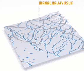 Places with similar names to Imām al Hājj Yūsuf, Iraq :: Disclaimer :: Information on this page comes without warranty of any kind |
||
|
Where is Imām al Hājj Yūsuf? Elevation and coordinates ::
Latitude (lat): 33°41'3"N Longitude (lon): 45°29'29"E
Elevation (approx.): 67m (map arrows pan, magnifying glasses zoom) |
||
|
Visiting Imām al Hājj Yūsuf? Hotel/Accommodation ::
Book a hotel in Imām al Hājj Yūsuf Travel Guide ::
Buy a travel guide for Iraq rental cars ::
car rental offers GPS waypoint ::
download a GPX waypoint (PoI) of Imām al Hājj Yūsuf for your GPS receiver
|
||