|
search place name
|
||
Kandālaqal (Arbīl, Iraq)Kandālaqal is a town in the Arbīl region of Iraq. An overview map of the region around Kandālaqal is displayed below.
regional and 3d topo map of Kandālaqal, Iraq ::
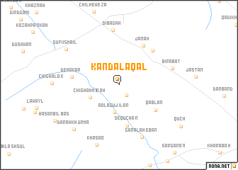
Nearby towns ::
Chaltūk (1.9km south east) //
Aola Gujilān (4.3km south) //
Chīghah Mīrah (4.2km south west) //
Se Quchan (6.5km south) //
Qablān (6.2km south east) //
Jānah (7.0km north east) //
Tikālah (6.9km north east) //
Demakar (6.2km west) //
Dībagah (8.6km north) //
Birabat (7.3km east) //
Gara Lahēbān (8.7km south) //
Dārah Khurmā (9.0km south west) //
Şūfī Ismā‘īl (8.8km north west) //
[all distances 'as the bird flies' and approximate] 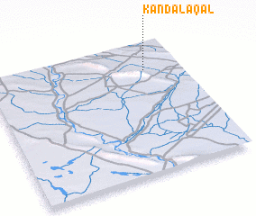 Places with similar names to Kandālaqal, Iraq ::
Disclaimer :: Information on this page comes without warranty of any kind |
||
|
Where is Kandālaqal? Elevation and coordinates ::
Latitude (lat): 35°47'56"N Longitude (lon): 43°49'2"E
Elevation (approx.): 296m (map arrows pan, magnifying glasses zoom) |
||
|
Visiting Kandālaqal? Hotel/Accommodation ::
Book a hotel in Kandālaqal Travel Guide ::
Buy a travel guide for Iraq rental cars ::
car rental offers GPS waypoint ::
download a GPX waypoint (PoI) of Kandālaqal for your GPS receiver
|
||