|
search place name
|
||
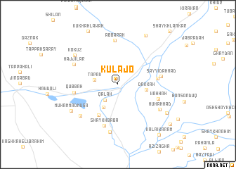
Kulajō (Diyālá, Iraq)Kulajō is a town in the Diyālá region of Iraq. An overview map of the region around Kulajō is displayed below.
regional and 3d topo map of Kulajō, Iraq ::
Kulajō airports ::
The nearest airport is KSH - Bakhtaran Shahid Ashrafi Esfahani, located 184.2 km east of Kulajō.
Other airports nearby include SDG - Sanandaj (190.4 km north east), Nearby towns ::
Qal‘ah (3.1km south west) //
Tapān (3.2km west) //
Tappah Charmī (4.1km south west) //
Dakkah (3.8km east) //
Kand Sūr (5.5km south west) //
Dakkah Sarchain (5.3km east) //
Waḩḩah (5.8km south east) //
Shaykh Bābā (6.8km south) //
‘Abbārah (7.0km north) //
Sayyid Aḩmad (5.8km east) //
Qubbah (5.9km west) //
Amīn Ḩabīb (7.6km south) //
Ḩājjīlar (6.6km north west) //
Muḩammad (6.8km south east) //
‘Alwash (7.0km south west) //
Kōkuz (7.3km north west) //
Muḩammad Mūsā (7.4km south west) //
Qarah Būlāq (8.5km north east) //
Majīd Sa‘īd (7.8km south east) //
Kūkhah Lāwah (9.3km north west) //
Kalai Karam (9.6km south east) //
Ḩamad Muşāliḩ (9.4km south east) //
Shaykh Lankar (10.8km north east) //
[all distances 'as the bird flies' and approximate] 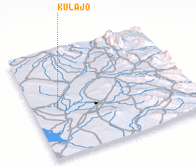 Places with similar names to Kulajō, Iraq ::
Disclaimer :: Information on this page comes without warranty of any kind |
||
|
Where is Kulajō? Elevation and coordinates ::
Latitude (lat): 34°27'28"N Longitude (lon): 45°9'35"E
Elevation (approx.): 151m (map arrows pan, magnifying glasses zoom) |
||
|
Visiting Kulajō? Hotel/Accommodation ::
Book a hotel in Kulajō Travel Guide ::
Buy a travel guide for Iraq rental cars ::
car rental offers GPS waypoint ::
download a GPX waypoint (PoI) of Kulajō for your GPS receiver
|
||