|
search place name
|
||
Kuraydī ad Darb (Bābil, Iraq)Kuraydī ad Darb is a town in the Bābil region of Iraq. An overview map of the region around Kuraydī ad Darb is displayed below.
regional and 3d topo map of Kuraydī ad Darb, Iraq ::
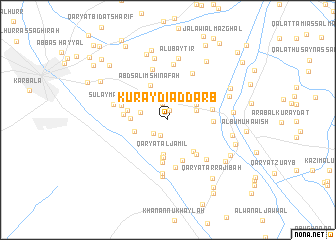
Nearby towns ::
Qaryat an Nabhānīyah (1.1km north) //
Qaryat Muḩammad Bin ‘Abd Allāh (1.9km south) //
Banī Şāliḩ (2.0km north) //
Qaryat Nāşr Āghā (2.1km north) //
‘Arab Ālbū ‘Aţshān (2.0km south west) //
Qaryat Ţanūbah (2.7km west) //
Hādī Jum‘ah (2.9km east) //
Qal‘at Shaykh ‘Awdah (3.2km north east) //
Qaryat al Jamīl (3.9km south) //
Qaryat aş Şakhr al ‘Arabī (3.4km west) //
Qaryat az Zaylīyah (3.5km west) //
Qaryat Ḩasan Bin Farhūd (4.2km south) //
‘Arab Kāz̧im Sitār (4.2km south) //
‘Abd Sālim Shināfah (4.2km north west) //
Qaryat al Ḩaylah (4.2km south east) //
‘Arab Ḩasan Kurdī (4.0km west) //
‘Abd ar Riḑāʼ Muzhir (4.8km south) //
Şāfī Ḩusayn (4.7km south) //
‘Abd ‘Alī al Mullā Hadhdhāl (4.7km south east) //
Muḩammad Hātif (4.2km west) //
Qaşr Hādī al Qazwīnī (4.2km east) //
Janājah (4.2km east) //
Sulţān Jabr (4.3km east) //
Mahdī Ḩusayn (5.4km south) //
Kāz̧im al Bukān (4.7km west) //
Qaryat Kafr Qāsim (5.7km north east) //
Qaryat az Za‘abīyah (5.8km north) //
Muḩammad Yāsīn (6.0km south) //
Şāliḩ Mahdī (5.7km south east) //
[all distances 'as the bird flies' and approximate] 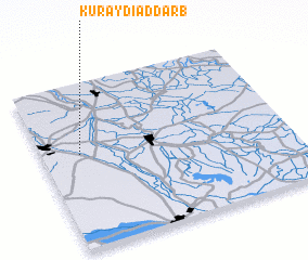 Places with similar names to Kuraydī ad Darb, Iraq :: Disclaimer :: Information on this page comes without warranty of any kind |
||
|
Where is Kuraydī ad Darb? Elevation and coordinates ::
Latitude (lat): 32°34'4"N Longitude (lon): 44°9'17"E
Elevation (approx.): 34m (map arrows pan, magnifying glasses zoom) |
||
|
Visiting Kuraydī ad Darb? Hotel/Accommodation ::
Book a hotel in Kuraydī ad Darb Travel Guide ::
Buy a travel guide for Iraq rental cars ::
car rental offers GPS waypoint ::
download a GPX waypoint (PoI) of Kuraydī ad Darb for your GPS receiver
|
||