|
search place name
|
||
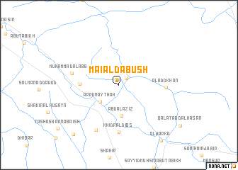
Māʼı‘ Āl Dabūsh (Al Muthanná, Iraq)Māʼı‘ Āl Dabūsh is a town in the Al Muthanná region of Iraq. An overview map of the region around Māʼı‘ Āl Dabūsh is displayed below.
regional and 3d topo map of Māʼı‘ Āl Dabūsh, Iraq ::
Māʼı‘ Āl Dabūsh airports ::
The nearest airport is RAH - Rafha, located 270.9 km south west of Māʼı‘ Āl Dabūsh.
Nearby towns ::
‘Abd ‘Alī (1.5km north east) //
Ar Rumaythah (3.7km south west) //
‘Abd al ‘Azīz (4.9km south) //
Nı‘mah Bin Ḩamūd (5.2km west) //
Aladd Khān (6.3km east) //
Khiḑr Āl Dibs (7.4km south) //
Muḩammad al ‘Abbās (6.6km west) //
As Sayyid Jāsim (7.8km south west) //
Sayyid Jābir (9.9km south west) //
Al Warkāʼ (10.5km south east) //
[all distances 'as the bird flies' and approximate] 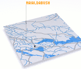 Places with similar names to Māʼı‘ Āl Dabūsh, Iraq :: Disclaimer :: Information on this page comes without warranty of any kind |
||
|
Where is Māʼı‘ Āl Dabūsh? Elevation and coordinates ::
Latitude (lat): 31°33'0"N Longitude (lon): 45°14'0"E
Elevation (approx.): 13m (map arrows pan, magnifying glasses zoom) |
||
|
Visiting Māʼı‘ Āl Dabūsh? Hotel/Accommodation ::
Book a hotel in Māʼı‘ Āl Dabūsh Travel Guide ::
Buy a travel guide for Iraq rental cars ::
car rental offers GPS waypoint ::
download a GPX waypoint (PoI) of Māʼı‘ Āl Dabūsh for your GPS receiver
|
||