|
search place name
|
||
Māmā Mahmūdah (As Sulaymānīyah, Iraq)Māmā Mahmūdah is a town in the As Sulaymānīyah region of Iraq. An overview map of the region around Māmā Mahmūdah is displayed below.
regional and 3d topo map of Māmā Mahmūdah, Iraq ::
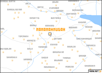
Nearby towns ::
Huwāwān (1.0km south east) //
Huwāwān-i Khwārū (2.3km south) //
Kānī Kand (2.9km north) //
Qayşarī (3.0km south east) //
Hamabāyizān (3.1km north west) //
Mizgōtōka (3.4km south west) //
Eski Koi (4.2km south) //
Kātrōshī (3.5km west) //
Koi Sanjaq (4.0km west) //
Siwasān (4.7km south east) //
Yāramish (5.5km south west) //
Bustānah (5.9km north) //
Kamila-ī Khwārū (5.4km west) //
Bāwājī (5.9km north west) //
Bāmurdkān (7.3km south) //
Abdalan (7.0km south west) //
Harmōta (6.3km south west) //
Mīr Sayyid (7.4km north west) //
Bādawān (7.0km east) //
Bāqilān (7.1km east) //
Qasrok (8.7km north) //
Shōgir (9.0km south) //
Awdālōk (7.9km south east) //
Shīla (8.3km south west) //
Qūmţarān (9.4km north east) //
[all distances 'as the bird flies' and approximate] 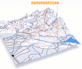 Places with similar names to Māmā Mahmūdah, Iraq :: Disclaimer :: Information on this page comes without warranty of any kind |
||
|
Where is Māmā Mahmūdah? Elevation and coordinates ::
Latitude (lat): 36°5'26"N Longitude (lon): 44°40'19"E
Elevation (approx.): 696m (map arrows pan, magnifying glasses zoom) |
||
|
Visiting Māmā Mahmūdah? Hotel/Accommodation ::
Book a hotel in Māmā Mahmūdah Travel Guide ::
Buy a travel guide for Iraq rental cars ::
car rental offers GPS waypoint ::
download a GPX waypoint (PoI) of Māmā Mahmūdah for your GPS receiver
|
||