|
search place name
|
||
Manqūbat Jadīd (Nīnawá, Iraq)Manqūbat Jadīd is a town in the Nīnawá region of Iraq. An overview map of the region around Manqūbat Jadīd is displayed below.
regional and 3d topo map of Manqūbat Jadīd, Iraq ::
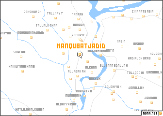
Nearby towns ::
Manqūr ‘Atīq (1.4km south east) //
Daynij (3.0km north west) //
Ḩamīdīyah Sharqī (3.2km south west) //
Duwayzāt Taḩtānī (3.5km north east) //
Tulūl an Nāşir (4.0km north) //
Al Khān (3.8km south east) //
Adchaych (4.2km north) //
Umm al Manāsīs (3.5km west) //
Al Lazākah (4.2km south) //
Al Ḩaḑrah (4.4km north) //
Tall ash Shuwayr (3.7km east) //
Al Ḩaws (5.3km south) //
Akjīj (5.3km north west) //
Duwayzāt Fawqānī (5.7km north east) //
Ash Shuwayrah (5.5km north west) //
Rijl al Aḩmar (6.6km north) //
Na‘nā‘ah (6.6km north) //
Makkūk (6.4km south east) //
Sayyid Āwah (7.4km south) //
Nus Tel (7.4km north) //
Zahrat Khātūn (7.4km north west) //
Sulţān ‘Abd Allāh (6.7km south east) //
As Safīnah (8.6km north) //
Khabāţah (8.7km south) //
Makhlaţ (8.7km north) //
Tall al Mahar (9.1km north west) //
Şalāḩīyah (9.8km south east) //
‘Ayn Marmīyah (10.0km south east) //
[all distances 'as the bird flies' and approximate] 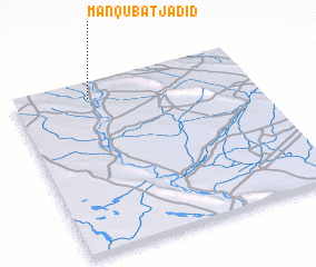 Places with similar names to Manqūbat Jadīd, Iraq :: Disclaimer :: Information on this page comes without warranty of any kind |
||
|
Where is Manqūbat Jadīd? Elevation and coordinates ::
Latitude (lat): 35°54'27"N Longitude (lon): 43°19'14"E
Elevation (approx.): 218m (map arrows pan, magnifying glasses zoom) |
||
|
Visiting Manqūbat Jadīd? Hotel/Accommodation ::
Book a hotel in Manqūbat Jadīd Travel Guide ::
Buy a travel guide for Iraq rental cars ::
car rental offers GPS waypoint ::
download a GPX waypoint (PoI) of Manqūbat Jadīd for your GPS receiver
|
||