|
search place name
|
||
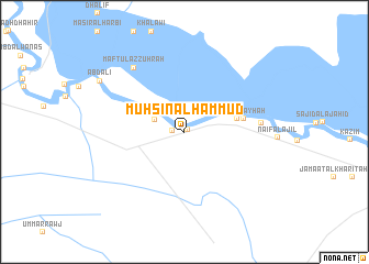
Muḩsin Āl Ḩammūd (Al Muthanná, Iraq)Muḩsin Āl Ḩammūd is a town in the Al Muthanná region of Iraq. An overview map of the region around Muḩsin Āl Ḩammūd is displayed below.
regional and 3d topo map of Muḩsin Āl Ḩammūd, Iraq ::
Muḩsin Āl Ḩammūd airports ::
The nearest airport is BSR - Basrah Intl, located 199.8 km east of Muḩsin Āl Ḩammūd.
Nearby towns ::
Khanjar ath Thuwaynī (0.3km north east) //
Kāz̧im Āl Muḩammad (1.0km west) //
Ad Darrājī (3.0km north east) //
Nāşir Āl ‘Ājil (2.8km north west) //
Jabr ad Dāwūd (4.8km east) //
Āl Şubayḩah (5.3km east) //
Maz‘al al Kāţi‘ (6.8km east) //
Maftūl az Zuhrah (7.8km north west) //
‘Abd ‘Alī (9.0km north west) //
[all distances 'as the bird flies' and approximate]  Places with similar names to Muḩsin Āl Ḩammūd, Iraq :: Disclaimer :: Information on this page comes without warranty of any kind |
||
|
Where is Muḩsin Āl Ḩammūd? Elevation and coordinates ::
Latitude (lat): 31°9'30"N Longitude (lon): 45°41'47"E
Elevation (approx.): 9m (map arrows pan, magnifying glasses zoom) |
||
|
Visiting Muḩsin Āl Ḩammūd? Hotel/Accommodation ::
Book a hotel in Muḩsin Āl Ḩammūd Travel Guide ::
Buy a travel guide for Iraq rental cars ::
car rental offers GPS waypoint ::
download a GPX waypoint (PoI) of Muḩsin Āl Ḩammūd for your GPS receiver
|
||