|
search place name
|
||
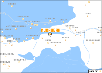
Mukabbah (Dhī Qār, Iraq)Mukabbah is a town in the Dhī Qār region of Iraq. An overview map of the region around Mukabbah is displayed below.
regional and 3d topo map of Mukabbah, Iraq ::
Mukabbah airports ::
The nearest airport is BSR - Basrah Intl, located 93.9 km south east of Mukabbah.
Other airports nearby include ABD - Abadan (151.4 km south east), AWZ - Ahwaz (193.9 km east), KWI - Kuwait Intl (220.4 km south east), Nearby towns ::
‘Ibādah (2.5km south west) //
Saynakh (2.8km west) //
Nahr al ‘Abd (3.4km south east) //
Khayrī (4.7km east) //
Ālbū ‘Aysh (5.8km north) //
Āl Jawwil (6.0km north west) //
Sayyid ‘Abd ‘Alī (5.7km west) //
Lamlūm (6.6km north east) //
Al Ḩājj Khālid (6.6km north west) //
Al Ḩammār (6.7km north east) //
Al Khāwīyah (7.1km north west) //
Nāḩiyat al Fuhūd (7.6km north west) //
[all distances 'as the bird flies' and approximate] 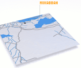 Places with similar names to Mukabbah, Iraq ::
Disclaimer :: Information on this page comes without warranty of any kind |
||
|
Where is Mukabbah? Elevation and coordinates ::
Latitude (lat): 30°55'41"N Longitude (lon): 46°47'8"E
Elevation (approx.): 4m (map arrows pan, magnifying glasses zoom) |
||
|
Visiting Mukabbah? Hotel/Accommodation ::
Book a hotel in Mukabbah Travel Guide ::
Buy a travel guide for Iraq rental cars ::
car rental offers GPS waypoint ::
download a GPX waypoint (PoI) of Mukabbah for your GPS receiver
|
||