|
search place name
|
||
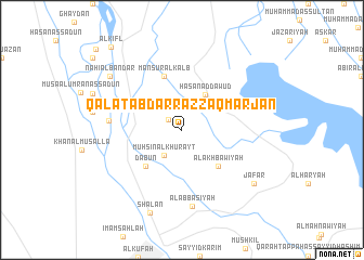
Qal‘at ‘Abd ar Razzāq Marjān (An Najaf, Iraq)Qal‘at ‘Abd ar Razzāq Marjān is a town in the An Najaf region of Iraq. An overview map of the region around Qal‘at ‘Abd ar Razzāq Marjān is displayed below.
regional and 3d topo map of Qal‘at ‘Abd ar Razzāq Marjān, Iraq ::
Nearby towns ::
Sayyid Ibrāhīm (1.6km north west) //
Muḩsin al Khurayţ (3.1km south west) //
Ḩasan ad Dāwūd (4.1km north east) //
Dab‘ūn (4.9km south west) //
Sayyid Şāliḩ (4.9km south west) //
Al Akhbāwīyah (4.9km south east) //
Manşūr al Kalb (5.8km north) //
Āl ‘Abbās (6.4km west) //
Al ‘Abbāsīyah (8.0km south) //
Sha‘lān (9.0km south) //
Nāhī al Bandar (8.4km north west) //
Ja‘far (8.4km south east) //
Al Kifl (10.5km north west) //
Īshān ‘Armīzān (11.2km north west) //
[all distances 'as the bird flies' and approximate]  Places with similar names to Qal‘at ‘Abd ar Razzāq Marjān, Iraq :: Disclaimer :: Information on this page comes without warranty of any kind |
||
|
Where is Qal‘at ‘Abd ar Razzāq Marjān? Elevation and coordinates ::
Latitude (lat): 32°9'0"N Longitude (lon): 44°26'0"E
Elevation (approx.): 25m (map arrows pan, magnifying glasses zoom) |
||
|
Visiting Qal‘at ‘Abd ar Razzāq Marjān? Hotel/Accommodation ::
Book a hotel in Qal‘at ‘Abd ar Razzāq Marjān Travel Guide ::
Buy a travel guide for Iraq rental cars ::
car rental offers GPS waypoint ::
download a GPX waypoint (PoI) of Qal‘at ‘Abd ar Razzāq Marjān for your GPS receiver
|
||