|
search place name
|
||
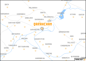
Qarah Cham (At Taʼmīm, Iraq)Qarah Cham is a town in the At Taʼmīm region of Iraq. An overview map of the region around Qarah Cham is displayed below.
regional and 3d topo map of Qarah Cham, Iraq ::
Nearby towns ::
Dirkī Aryān (2.8km west) //
Shināghah (3.9km north) //
Bāy Ḩasan (3.6km south west) //
Dibs (3.9km north east) //
Mushayifah (5.0km south) //
Malhah Wālī (5.4km north east) //
Abū Kharjah (6.2km south) //
Sartū (6.7km north) //
Gābilakā (6.6km north west) //
Shīrnāw (7.4km south) //
Derkē Kitchka (6.7km west) //
Malḩah (7.9km south west) //
Māmah (9.3km south) //
Palkānah (9.5km north) //
Kargatu (9.2km north east) //
Sayyid Aḩmad (10.6km south west) //
[all distances 'as the bird flies' and approximate]  Places with similar names to Qarah Cham, Iraq ::
Disclaimer :: Information on this page comes without warranty of any kind |
||
|
Where is Qarah Cham? Elevation and coordinates ::
Latitude (lat): 35°38'51"N Longitude (lon): 44°2'41"E
Elevation (approx.): 238m (map arrows pan, magnifying glasses zoom) |
||
|
Visiting Qarah Cham? Hotel/Accommodation ::
Book a hotel in Qarah Cham Travel Guide ::
Buy a travel guide for Iraq rental cars ::
car rental offers GPS waypoint ::
download a GPX waypoint (PoI) of Qarah Cham for your GPS receiver
|
||