|
search place name
|
||
Salmān Āl ‘Ayţān (Al Qādisīyah, Iraq)Salmān Āl ‘Ayţān is a town in the Al Qādisīyah region of Iraq. An overview map of the region around Salmān Āl ‘Ayţān is displayed below.
regional and 3d topo map of Salmān Āl ‘Ayţān, Iraq ::

Nearby towns ::
As Sayyid Ḩamūd (0.5km north) //
Ḩusayn Bājī (1.5km east) //
Al Mabarr Rasūl (1.7km north) //
Ḩasan Āl Jazzār (2.0km south east) //
Şabīḩ Jabbār (3.5km south east) //
Ţārish al Baghdādī (3.5km north west) //
As Sayyid ‘Uşfūr (4.5km north west) //
Al Ḩājj ‘Alāwī wa Mahdī (4.5km north west) //
Qal‘at Umm Kull Sab‘ al Qadīmah (4.3km east) //
As Sudayr (5.6km north) //
Al Ḩamzah (6.1km south) //
‘Azīz Kazār (8.0km south) //
Nabī Ways (7.7km north west) //
Āl Zuwayr (7.7km north west) //
Zabbālat Āl Maţrūd (7.8km north west) //
Rīkān (9.0km south) //
‘Azīz Allah (8.7km south west) //
Āl Şabbāḩ (8.0km west) //
‘Abd ‘Alī (9.4km south east) //
Ghāzī Idrīs (8.8km north west) //
Ālbū Maţar (9.0km north west) //
[all distances 'as the bird flies' and approximate] 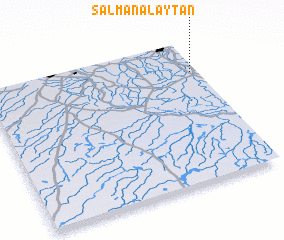 Places with similar names to Salmān Āl ‘Ayţān, Iraq :: Disclaimer :: Information on this page comes without warranty of any kind |
||
|
Where is Salmān Āl ‘Ayţān? Elevation and coordinates ::
Latitude (lat): 31°46'45"N Longitude (lon): 44°58'7"E
Elevation (approx.): 20m (map arrows pan, magnifying glasses zoom) |
||
|
Visiting Salmān Āl ‘Ayţān? Hotel/Accommodation ::
Book a hotel in Salmān Āl ‘Ayţān Travel Guide ::
Buy a travel guide for Iraq rental cars ::
car rental offers GPS waypoint ::
download a GPX waypoint (PoI) of Salmān Āl ‘Ayţān for your GPS receiver
|
||