|
search place name
|
||
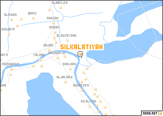
Silk al ‘Aţīyah (Al Başrah, Iraq)Silk al ‘Aţīyah is a town in the Al Başrah region of Iraq. An overview map of the region around Silk al ‘Aţīyah is displayed below.
regional and 3d topo map of Silk al ‘Aţīyah, Iraq ::
Silk al ‘Aţīyah airports ::
The nearest airport is BSR - Basrah Intl, located 51.1 km south of Silk al ‘Aţīyah.
Other airports nearby include ABD - Abadan (98.5 km south east), AWZ - Ahwaz (128.1 km east), MRX - Bandar Mahshahr Mahshahr (166.6 km east), KWI - Kuwait Intl (200.3 km south), Nearby towns ::
As Suwayyib (2.6km south east) //
Dowa (3.4km south) //
Shalḩah (3.4km south west) //
Ash Shāhīn (3.4km west) //
Shāmlī (5.0km south) //
Al Muzayrah (5.0km north west) //
Aş Şuwaydı‘ (4.8km west) //
Shahbāzīyah (5.6km south) //
Al Jala‘ah (6.4km south west) //
Al Qurnah (6.2km north west) //
Ḩuwayzah (7.4km south) //
‘Awjān (6.6km west) //
Nuhayrāt (7.1km north west) //
Chalabīyah (7.7km south) //
Arrar (7.9km north west) //
Qaryat ‘Alī Nūr (8.7km south) //
Bayt Sayyid Nūr (9.4km south) //
Mawzah (9.8km north west) //
[all distances 'as the bird flies' and approximate] 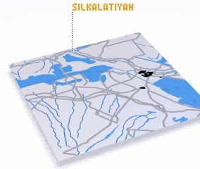 Places with similar names to Silk al ‘Aţīyah, Iraq :: Disclaimer :: Information on this page comes without warranty of any kind |
||
|
Where is Silk al ‘Aţīyah? Elevation and coordinates ::
Latitude (lat): 30°59'0"N Longitude (lon): 47°29'0"E
Elevation (approx.): 5m (map arrows pan, magnifying glasses zoom) |
||
|
Visiting Silk al ‘Aţīyah? Hotel/Accommodation ::
Book a hotel in Silk al ‘Aţīyah Travel Guide ::
Buy a travel guide for Iraq rental cars ::
car rental offers GPS waypoint ::
download a GPX waypoint (PoI) of Silk al ‘Aţīyah for your GPS receiver
|
||