|
search place name
|
||
‘Umar Khuwā ‘Ulyā (As Sulaymānīyah, Iraq)‘Umar Khuwā ‘Ulyā is a town in the As Sulaymānīyah region of Iraq. An overview map of the region around ‘Umar Khuwā ‘Ulyā is displayed below.
regional and 3d topo map of ‘Umar Khuwā ‘Ulyā, Iraq ::
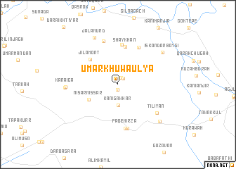
Nearby towns ::
‘Umar Khuwādah (0.8km south) //
Awr Bakah (1.1km north) //
Awr Bākah (1.2km north east) //
KāniGawhar (3.3km south) //
Nişār Mişşār (4.5km south west) //
Garaw (4.8km north east) //
Jilamōrt (5.4km north west) //
Shaykhān (6.1km north) //
Sarchinār (6.3km north) //
Nam Lasi (6.4km north east) //
Faqē Mīrza (7.0km south) //
Fakāymizzā (7.1km south) //
Tutagari (7.1km north) //
Tiliyān (6.8km south east) //
Jalāmurd (8.0km north) //
Kāraiga (6.8km west) //
Kāraiga (6.9km west) //
Iskandar Baygī (7.7km north east) //
Kānī ‘Abān (8.0km south east) //
[all distances 'as the bird flies' and approximate] 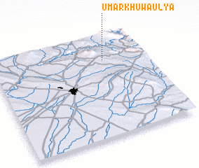 Places with similar names to ‘Umar Khuwā ‘Ulyā, Iraq :: Disclaimer :: Information on this page comes without warranty of any kind |
||
|
Where is ‘Umar Khuwā ‘Ulyā? Elevation and coordinates ::
Latitude (lat): 35°46'0"N Longitude (lon): 44°44'0"E
Elevation (approx.): 682m (map arrows pan, magnifying glasses zoom) |
||
|
Visiting ‘Umar Khuwā ‘Ulyā? Hotel/Accommodation ::
Book a hotel in ‘Umar Khuwā ‘Ulyā Travel Guide ::
Buy a travel guide for Iraq rental cars ::
car rental offers GPS waypoint ::
download a GPX waypoint (PoI) of ‘Umar Khuwā ‘Ulyā for your GPS receiver
|
||