|
search place name
|
||
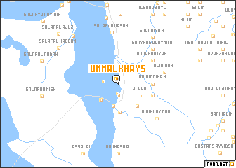
Umm al Khays (Maysān, Iraq)Umm al Khays is a town in the Maysān region of Iraq. An overview map of the region around Umm al Khays is displayed below.
regional and 3d topo map of Umm al Khays, Iraq ::
Umm al Khays airports ::
The nearest airport is BSR - Basrah Intl, located 130.1 km south east of Umm al Khays.
Other airports nearby include AWZ - Ahwaz (171.0 km east), ABD - Abadan (178.1 km south east), Nearby towns ::
Salaf al Mahnah (1.5km south) //
Al ‘Arīz (1.9km south) //
Salaf ad Duwaymah (2.0km west) //
Nāḩiyat as Salām (3.6km south) //
Salaf at Turkīyah (3.4km south west) //
Al ‘Arīḑ (3.7km south east) //
Umm al ‘Az̧ām (4.5km south) //
Al Ḩumayrah (4.4km south east) //
Umm al Ḩannah (4.7km east) //
Umm Laqlaq (4.7km east) //
Umm Qindīḩah (4.7km east) //
Shawwāy al Fahd (5.1km east) //
Shādī Fahd (5.1km east) //
Ad Dahāmīyah (6.0km north east) //
Al ‘Awdah (6.6km east) //
Shaykh Sulaymān (7.3km north east) //
Salaf Jamāsah (8.3km north) //
Umm Ku‘aydah (7.7km south east) //
Şalāḩīyah (8.8km north east) //
Salaf an Nāşirīyah (9.7km north west) //
[all distances 'as the bird flies' and approximate]  Places with similar names to Umm al Khays, Iraq :: Disclaimer :: Information on this page comes without warranty of any kind |
||
|
Where is Umm al Khays? Elevation and coordinates ::
Latitude (lat): 31°34'0"N Longitude (lon): 46°59'0"E
Elevation (approx.): 8m (map arrows pan, magnifying glasses zoom) |
||
|
Visiting Umm al Khays? Hotel/Accommodation ::
Book a hotel in Umm al Khays Travel Guide ::
Buy a travel guide for Iraq rental cars ::
car rental offers GPS waypoint ::
download a GPX waypoint (PoI) of Umm al Khays for your GPS receiver
|
||