|
search place name
|
||
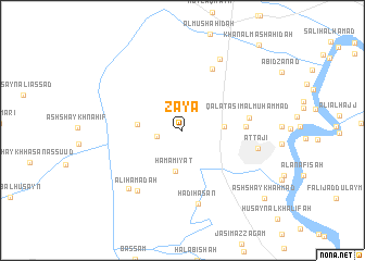
Zāyā (Baghdād, Iraq)Zāyā is a town in the Baghdād region of Iraq. An overview map of the region around Zāyā is displayed below.
regional and 3d topo map of Zāyā, Iraq ::
Nearby towns ::
Manājid al Ḩamad (2.3km west) //
Ḩamāmīyat (4.2km south) //
Ḩamdī al Pāchachī (3.6km east) //
Sulaymān Naz̧īf (3.9km west) //
Ibrāhīm Aḩmad (5.5km east) //
Jashmal Ḩamdī (6.8km north) //
Qal‘at ‘Āşim al Muḩammad (5.9km east) //
Hādī Ḩasan (7.7km south) //
‘Alī Ḩamādah (7.3km south west) //
At Tājī (6.7km east) //
Bayt Sharīf (7.5km south west) //
‘Arab Ţarīq al ‘Askarī (8.0km north east) //
Ash Shaykh Aḩmad (9.9km south east) //
Khān al Mashāhidah (11.0km north east) //
[all distances 'as the bird flies' and approximate]  Places with similar names to Zāyā, Iraq ::
Disclaimer :: Information on this page comes without warranty of any kind |
||
|
Where is Zāyā? Elevation and coordinates ::
Latitude (lat): 33°32'46"N Longitude (lon): 44°12'28"E
Elevation (approx.): 35m (map arrows pan, magnifying glasses zoom) |
||
|
Visiting Zāyā? Hotel/Accommodation ::
Book a hotel in Zāyā Travel Guide ::
Buy a travel guide for Iraq rental cars ::
car rental offers GPS waypoint ::
download a GPX waypoint (PoI) of Zāyā for your GPS receiver
|
||