|
search place name
|
||
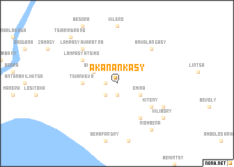
Akanankasy (Toliara, Madagascar)Akanankasy is a town in the Toliara region of Madagascar. An overview map of the region around Akanankasy is displayed below.
regional and 3d topo map of Akanankasy, Madagascar ::
Akanankasy airports ::
The nearest airport is TLE - Toliara, located 189.5 km north of Akanankasy.
Nearby towns ::
Ankady (1.9km south) //
Ankasina (1.7km west) //
Ankobe (2.5km south west) //
Beomby (3.8km north west) //
Emina (3.8km south east) //
Tsiankeva (5.0km west) //
Kiteny (6.3km south east) //
Beavoha Avaratra (6.5km south east) //
Lampasy Atsimo (6.3km north west) //
Beharahaka (6.3km north west) //
Ankalangasy (7.5km north east) //
Lampasy Avaratra (7.5km north west) //
Antainkomby (7.7km south east) //
Niombena (9.0km south east) //
Kilibory (8.7km south east) //
Tsiarindrano (10.0km north west) //
[all distances 'as the bird flies' and approximate] 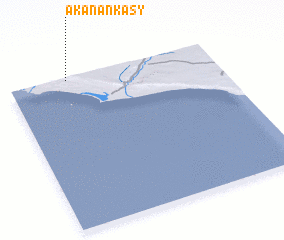 Places with similar names to Akanankasy, Madagascar :: Disclaimer :: Information on this page comes without warranty of any kind |
||
|
Where is Akanankasy? Elevation and coordinates ::
Latitude (lat): 25°1'0"S Longitude (lon): 44°17'0"E
Elevation (approx.): 148m (map arrows pan, magnifying glasses zoom) |
||
|
Visiting Akanankasy? Hotel/Accommodation ::
Book a hotel in Akanankasy Travel Guide ::
Buy a travel guide for Madagascar rental cars ::
car rental offers GPS waypoint ::
download a GPX waypoint (PoI) of Akanankasy for your GPS receiver
|
||