|
search place name
|
||
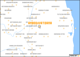
Ambodivatoana (Antsiranana, Madagascar)Ambodivatoana is a town in the Antsiranana region of Madagascar. An overview map of the region around Ambodivatoana is displayed below.
regional and 3d topo map of Ambodivatoana, Madagascar ::
Ambodivatoana airports ::
The nearest airport is VOH - Vohemar Vohimarina, located 50.6 km north of Ambodivatoana.
Other airports nearby include SVB - Sambava (52.8 km south), ZWA - Andapa (99.4 km south west), AMB - Ambilobe (130.7 km north west), ANM - Antalaha Antsirabato (133.6 km south), Nearby towns ::
Ambatojoby (2.6km north west) //
Antanamiketroma (2.6km south west) //
Antanankova (3.6km west) //
Marotongotra (4.0km north west) //
Ambodisaina (4.1km south east) //
Antambolina (5.2km north west) //
Ambalamandry (5.2km south east) //
Ampanefena (5.2km south west) //
Ambahivahy (5.8km north) //
Tsivolanana (6.6km north west) //
Befandriana (6.5km south west) //
Andravinakoho (7.2km west) //
Amboditsoba (7.6km north) //
Berombabe (7.4km west) //
Mahazava (7.7km south west) //
Manasamody (8.2km south west) //
[all distances 'as the bird flies' and approximate] 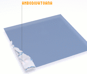 Places with similar names to Ambodivatoana, Madagascar ::
// Ambodivatoana (MG)
Disclaimer :: Information on this page comes without warranty of any kind |
||
|
Where is Ambodivatoana? Elevation and coordinates ::
Latitude (lat): 13°50'0"S Longitude (lon): 50°0'0"E
Elevation (approx.): 450m (map arrows pan, magnifying glasses zoom) |
||
|
Visiting Ambodivatoana? Hotel/Accommodation ::
Book a hotel in Ambodivatoana Travel Guide ::
Buy a travel guide for Madagascar rental cars ::
car rental offers GPS waypoint ::
download a GPX waypoint (PoI) of Ambodivatoana for your GPS receiver
|
||