|
search place name
|
||
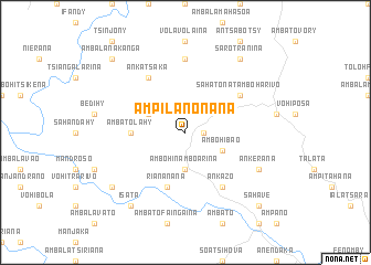
Ampilanonana (Fianarantsoa, Madagascar)Ampilanonana is a town in the Fianarantsoa region of Madagascar. An overview map of the region around Ampilanonana is displayed below.
regional and 3d topo map of Ampilanonana, Madagascar ::
Ampilanonana airports ::
The nearest airport is WFI - Fianarantsoa, located 49.3 km south of Ampilanonana.
Other airports nearby include MNJ - Mananjary (137.8 km east), WVK - Manakara (159.7 km south east), RVA - Farafangana (215.2 km south), ZVA - Miandrivazo (230.7 km north west), Nearby towns ::
Iatara (1.7km east) //
Ambohinamboarina (3.7km south) //
Ambahondrano (3.9km north west) //
Ambohibao (3.9km south east) //
Ambatolahy (5.2km west) //
Riananana (5.8km south) //
Ankatsaka (6.5km north west) //
Ankazo (6.5km south east) //
Sahatona-Tamboharivo (6.4km north east) //
Antaramaharivo (7.4km north) //
Ankerana (7.9km south east) //
Isata (9.0km south west) //
Sahavolo (8.9km south west) //
Sarotranina (9.1km north east) //
Ambalanakanga (10.1km north west) //
Sahave (10.1km south east) //
[all distances 'as the bird flies' and approximate] 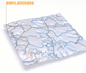 Places with similar names to Ampilanonana, Madagascar ::
// Ampilanonana (MG)
// Ampilanonana (MG)
Disclaimer :: Information on this page comes without warranty of any kind |
||
|
Where is Ampilanonana? Elevation and coordinates ::
Latitude (lat): 21°0'0"S Longitude (lon): 47°3'0"E
Elevation (approx.): 1082m (map arrows pan, magnifying glasses zoom) |
||
|
Visiting Ampilanonana? Hotel/Accommodation ::
Book a hotel in Ampilanonana Travel Guide ::
Buy a travel guide for Madagascar rental cars ::
car rental offers GPS waypoint ::
download a GPX waypoint (PoI) of Ampilanonana for your GPS receiver
|
||