|
search place name
|
||
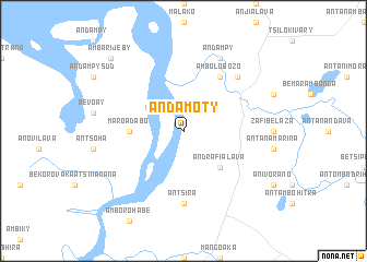
Andamoty (Mahajanga, Madagascar)Andamoty is a town in the Mahajanga region of Madagascar. An overview map of the region around Andamoty is displayed below.
regional and 3d topo map of Andamoty, Madagascar ::
Andamoty airports ::
The nearest airport is WAI - Antsohihy Ambalabe, located 18.5 km south of Andamoty.
Other airports nearby include HVA - Analalava (29.6 km north west), NOS - Nosy-be Fascene (160.5 km north), ZWA - Andapa (173.0 km east), WMN - Maroantsetra (195.8 km south east), Nearby towns ::
Andrafialava (5.2km south east) //
Maroadabo (5.4km west) //
Ambolobozo (6.6km north east) //
Antsira (7.4km south) //
Ambalasakoana (7.7km north east) //
Andampy (8.2km north east) //
Ambarijeby (10.3km north west) //
[all distances 'as the bird flies' and approximate] 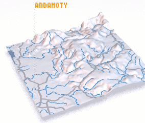 Places with similar names to Andamoty, Madagascar ::
Disclaimer :: Information on this page comes without warranty of any kind |
||
|
Where is Andamoty? Elevation and coordinates ::
Latitude (lat): 14°44'0"S Longitude (lon): 48°1'0"E
Elevation (approx.): 16m (map arrows pan, magnifying glasses zoom) |
||
|
Visiting Andamoty? Hotel/Accommodation ::
Book a hotel in Andamoty Travel Guide ::
Buy a travel guide for Madagascar rental cars ::
car rental offers GPS waypoint ::
download a GPX waypoint (PoI) of Andamoty for your GPS receiver
|
||