|
search place name
|
||
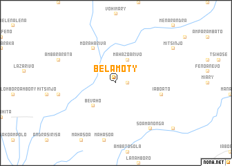
Belamoty (Toliara, Madagascar)Belamoty is a town in the Toliara region of Madagascar. An overview map of the region around Belamoty is displayed below.
regional and 3d topo map of Belamoty, Madagascar ::
Belamoty airports ::
The nearest airport is TLE - Toliara, located 184.9 km west of Belamoty.
Other airports nearby include FTU - Tolagnaro (195.8 km south east), Nearby towns ::
Ambalabe Avaratra (1.7km east) //
Ambalabe Atsimo (1.7km east) //
Mahazoarivo (4.1km north east) //
Bevaho (5.0km south west) //
Morahariva (6.5km north west) //
Iaboato (7.0km east) //
Soamanonga (9.0km south east) //
[all distances 'as the bird flies' and approximate] 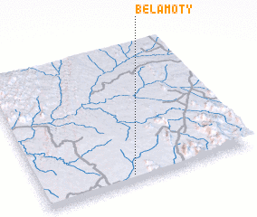 Places with similar names to Belamoty, Madagascar ::
// Bel Mahdi (MA)
// Balimeda (ET)
// Bellemeade (US)
// Balamata (CM)
// Belle Meade (US)
// Blümöd (DE)
// Belle Meade (US)
// Bellemead (US)
// Bellamota (CU)
// Beloomut (RU)
Disclaimer :: Information on this page comes without warranty of any kind |
||
|
Where is Belamoty? Elevation and coordinates ::
Latitude (lat): 23°57'0"S Longitude (lon): 45°26'0"E
Elevation (approx.): 546m (map arrows pan, magnifying glasses zoom) |
||
|
Visiting Belamoty? Hotel/Accommodation ::
Book a hotel in Belamoty Travel Guide ::
Buy a travel guide for Madagascar rental cars ::
car rental offers GPS waypoint ::
download a GPX waypoint (PoI) of Belamoty for your GPS receiver
|
||