|
search place name
|
||
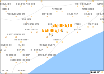
Beraketa (Toliara, Madagascar)Beraketa is a town in the Toliara region of Madagascar. An overview map of the region around Beraketa is displayed below.
regional and 3d topo map of Beraketa, Madagascar ::
Beraketa airports ::
The nearest airport is FTU - Tolagnaro, located 115.7 km east of Beraketa.
Nearby towns ::
Antsotry (1.7km west) //
Ambasy (2.5km south east) //
Ambinda (2.5km north east) //
Ambario (3.7km north) //
Ambanimantsaky (3.8km south east) //
Beraketa (3.8km north east) //
Ambazoamazava (4.1km south west) //
Ankazoabo (4.1km north east) //
Ambazoa (5.4km east) //
Anahidambo (5.4km west) //
Matofohy (6.2km north east) //
Kotoala-Tanambao (7.6km south) //
Ambatovato (7.0km west) //
Montifeno (7.6km north) //
Ambondro (7.6km north) //
Antanimihery (7.5km south west) //
Antsakoamanga (7.7km north west) //
Antanandava (10.0km north west) //
Belalitsy (10.0km north east) //
Analamamy (10.0km north east) //
[all distances 'as the bird flies' and approximate] 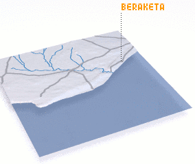 Places with similar names to Beraketa, Madagascar ::
Disclaimer :: Information on this page comes without warranty of any kind |
||
|
Where is Beraketa? Elevation and coordinates ::
Latitude (lat): 25°19'0"S Longitude (lon): 45°51'0"E
Elevation (approx.): 149m (map arrows pan, magnifying glasses zoom) |
||
|
Visiting Beraketa? Hotel/Accommodation ::
Book a hotel in Beraketa Travel Guide ::
Buy a travel guide for Madagascar rental cars ::
car rental offers GPS waypoint ::
download a GPX waypoint (PoI) of Beraketa for your GPS receiver
|
||