|
search place name
|
||
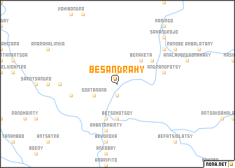
Besandrahy (Toliara, Madagascar)Besandrahy is a town in the Toliara region of Madagascar. An overview map of the region around Besandrahy is displayed below.
regional and 3d topo map of Besandrahy, Madagascar ::
Besandrahy airports ::
The nearest airport is FTU - Tolagnaro, located 103.4 km south east of Besandrahy.
Other airports nearby include RVA - Farafangana (253.3 km north east), Nearby towns ::
Ankaramena (1.9km north) //
Moraro (1.9km north) //
Ambonaivo (1.9km south) //
Soatanana (3.8km south west) //
Beraketa (5.0km north east) //
Betsomotsoy (5.6km south) //
Beakondro (5.8km south) //
Banay (6.3km north east) //
Anjahamboroka (7.0km west) //
Ambatomainty (7.6km south) //
Andranofotsy (7.0km east) //
Ankilimilapaka (8.7km north east) //
Ankamena (10.0km north east) //
Sahandrojo (10.0km north east) //
[all distances 'as the bird flies' and approximate]  Places with similar names to Besandrahy, Madagascar ::
// Busindre (ES)
// Besandra (MG)
// Besandrahy (MG)
// Besenetra (MG)
// Bow Center (US)
// Bay Center (US)
// Bāis Sindur (BD)
// Bissandérou (BF)
// Bouzandoré (CF)
// Bouzandori (CF)
Disclaimer :: Information on this page comes without warranty of any kind |
||
|
Where is Besandrahy? Elevation and coordinates ::
Latitude (lat): 24°29'0"S Longitude (lon): 46°8'0"E
Elevation (approx.): 122m (map arrows pan, magnifying glasses zoom) |
||
|
Visiting Besandrahy? Hotel/Accommodation ::
Book a hotel in Besandrahy Travel Guide ::
Buy a travel guide for Madagascar rental cars ::
car rental offers GPS waypoint ::
download a GPX waypoint (PoI) of Besandrahy for your GPS receiver
|
||