|
search place name
|
||
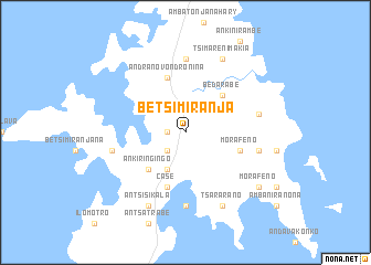
Betsimiranja (Antsiranana, Madagascar)Betsimiranja is a town in the Antsiranana region of Madagascar. An overview map of the region around Betsimiranja is displayed below.
regional and 3d topo map of Betsimiranja, Madagascar ::
Betsimiranja airports ::
The nearest airport is DIE - Antsiranana Arrachart, located 28.0 km south of Betsimiranja.
Other airports nearby include AMB - Ambilobe (123.7 km south), VOH - Vohemar Vohimarina (163.1 km south east), NOS - Nosy-be Fascene (168.2 km south west), Nearby towns ::
Antsahabe (1.8km west) //
Ankarafabe (2.6km south west) //
Ambavahibe (4.1km south west) //
Bedarabe (5.2km north east) //
Ankiringingo (5.2km south west) //
Morafeno (5.7km east) //
Andranovondronina (5.8km north) //
Case (5.8km south) //
Ambatoafo (7.4km north) //
Ampasikely (7.4km south) //
Andohonko (7.5km west) //
Anjiabe (7.5km east) //
Ampombofofo (7.5km east) //
Tsimarenimakia (8.3km north east) //
Antsisikala (8.3km south west) //
Tsararano (8.3km south east) //
Ambinanililabe (8.3km south east) //
Morafeno (9.1km south east) //
[all distances 'as the bird flies' and approximate] 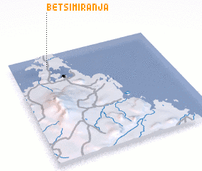 Places with similar names to Betsimiranja, Madagascar ::
// Betsimiranja (MG)
Disclaimer :: Information on this page comes without warranty of any kind |
||
|
Where is Betsimiranja? Elevation and coordinates ::
Latitude (lat): 12°6'0"S Longitude (lon): 49°15'0"E
Elevation (approx.): 92m (map arrows pan, magnifying glasses zoom) |
||
|
Visiting Betsimiranja? Hotel/Accommodation ::
Book a hotel in Betsimiranja Travel Guide ::
Buy a travel guide for Madagascar rental cars ::
car rental offers GPS waypoint ::
download a GPX waypoint (PoI) of Betsimiranja for your GPS receiver
|
||