|
search place name
|
||
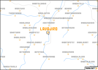
Lavajiro (Toamasina, Madagascar)Lavajiro is a town in the Toamasina region of Madagascar. An overview map of the region around Lavajiro is displayed below.
regional and 3d topo map of Lavajiro, Madagascar ::
Lavajiro airports ::
The nearest airport is MNJ - Mananjary, located 122.1 km south of Lavajiro.
Other airports nearby include TNR - Antananarivo Ivato (162.2 km north west), WFI - Fianarantsoa (182.2 km south west), Nearby towns ::
Vohitraomby (3.7km north) //
Andranabolava (4.1km south west) //
Marofatsy (5.2km west) //
Ambinanynisahanaho (5.8km north) //
Mahevelombady (6.4km south west) //
Antanifasina (7.2km east) //
Ambalakazaha (7.2km west) //
Maroleotra (7.6km north) //
Befotaka (8.2km south west) //
Marolambo (8.2km north west) //
Ambatofotsy (7.9km south east) //
Ambalaherana (7.9km north west) //
Ankodona (8.9km north east) //
Ambodiriana (10.2km south east) //
[all distances 'as the bird flies' and approximate] 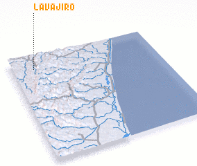 Places with similar names to Lavajiro, Madagascar ::
// Lifaj i Ri (AL)
// La Fajera (ES)
// La Ovejera (ES)
// Lavajiro (MG)
// Lavajiro (MG)
// Lavajiro (MG)
// La Ovejería (CL)
// La Ovejera (CO)
// La Ovejería (MX)
// La Ovejera (VE)
Disclaimer :: Information on this page comes without warranty of any kind |
||
|
Where is Lavajiro? Elevation and coordinates ::
Latitude (lat): 20°7'0"S Longitude (lon): 48°9'0"E
Elevation (approx.): 403m (map arrows pan, magnifying glasses zoom) |
||
|
Visiting Lavajiro? Hotel/Accommodation ::
Book a hotel in Lavajiro Travel Guide ::
Buy a travel guide for Madagascar rental cars ::
car rental offers GPS waypoint ::
download a GPX waypoint (PoI) of Lavajiro for your GPS receiver
|
||