|
search place name
|
||
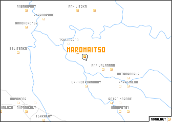
Maromaitso (Mahajanga, Madagascar)Maromaitso is a town in the Mahajanga region of Madagascar. An overview map of the region around Maromaitso is displayed below.
regional and 3d topo map of Maromaitso, Madagascar ::
Maromaitso airports ::
The nearest airport is BPY - Besalampy, located 159.6 km north west of Maromaitso.
Other airports nearby include ZVA - Miandrivazo (172.2 km south), Nearby towns ::
Ambalakazaha (2.6km north west) //
Ampivalanana (4.0km south east) //
Andakana (5.1km north west) //
Tsinjorano (5.1km north west) //
Vakihotro Ambany (5.6km south) //
Ambodivato (5.6km east) //
Amboloando (9.0km south east) //
[all distances 'as the bird flies' and approximate] 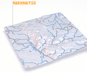 Places with similar names to Maromaitso, Madagascar ::
// Marimetsa (EE)
// Murru-Metsa (EE)
// Maromitsa (RU)
// Maromotso (MG)
// Mirim Doce (BR)
// Mramotice (CZ)
// Muramatsu (JP)
// Muramatsu (JP)
// Muramatsu (JP)
// Muramatsu (JP)
Disclaimer :: Information on this page comes without warranty of any kind |
||
|
Where is Maromaitso? Elevation and coordinates ::
Latitude (lat): 18°2'0"S Longitude (lon): 45°9'0"E
Elevation (approx.): 257m (map arrows pan, magnifying glasses zoom) |
||
|
Visiting Maromaitso? Hotel/Accommodation ::
Book a hotel in Maromaitso Travel Guide ::
Buy a travel guide for Madagascar rental cars ::
car rental offers GPS waypoint ::
download a GPX waypoint (PoI) of Maromaitso for your GPS receiver
|
||