|
search place name
|
||
Sitakoko (Fianarantsoa, Madagascar)Sitakoko is a town in the Fianarantsoa region of Madagascar. An overview map of the region around Sitakoko is displayed below.
regional and 3d topo map of Sitakoko, Madagascar ::

Sitakoko airports ::
The nearest airport is RVA - Farafangana, located 26.5 km south of Sitakoko.
Other airports nearby include WVK - Manakara (53.2 km north), WFI - Fianarantsoa (145.2 km north west), MNJ - Mananjary (160.6 km north), Nearby towns ::
Vakinasiva (3.7km south) //
Amboahangimasina (3.7km north) //
Ampasimpotsy (3.7km north) //
Imbasy (5.0km south west) //
Tsirobohina (5.5km west) //
Andranamby (6.3km north east) //
Loharano (6.5km south east) //
Enamora (8.2km south west) //
Ebono (8.2km north west) //
Nanavotra (7.8km north east) //
Mahiakoho (8.8km north west) //
[all distances 'as the bird flies' and approximate] 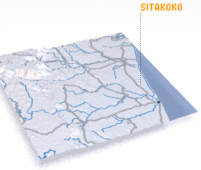 Places with similar names to Sitakoko, Madagascar ::
// Stöckig (DE)
// Stöckig (DE)
// Setugak (MY)
// Stecówka (PL)
// Situ-Kiaka (CD)
// Saitocco (PE)
// Sayto Occo (PE)
// Sayto Occo (PE)
// Suyto Occo (PE)
// Suyto Occo (PE)
Disclaimer :: Information on this page comes without warranty of any kind |
||
|
Where is Sitakoko? Elevation and coordinates ::
Latitude (lat): 22°34'0"S Longitude (lon): 47°50'0"E
Elevation (approx.): 7m (map arrows pan, magnifying glasses zoom) |
||
|
Visiting Sitakoko? Hotel/Accommodation ::
Book a hotel in Sitakoko Travel Guide ::
Buy a travel guide for Madagascar rental cars ::
car rental offers GPS waypoint ::
download a GPX waypoint (PoI) of Sitakoko for your GPS receiver
|
||