|
search place name
|
||
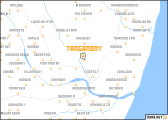
Tanganony (Fianarantsoa, Madagascar)Tanganony is a town in the Fianarantsoa region of Madagascar. An overview map of the region around Tanganony is displayed below.
regional and 3d topo map of Tanganony, Madagascar ::
Tanganony airports ::
The nearest airport is RVA - Farafangana, located 57.6 km north east of Tanganony.
Other airports nearby include WVK - Manakara (135.9 km north), FTU - Tolagnaro (205.1 km south), WFI - Fianarantsoa (210.1 km north), Nearby towns ::
Soamanova (0.0km north) //
Vohibato (1.9km north) //
Maroafo (1.9km north) //
Karimbary (2.5km south west) //
Mavogisy (3.7km north) //
Tsiately (4.1km south east) //
Ampasimalemy (5.8km south) //
Fonilaza (5.4km west) //
Ambolotara (6.5km north west) //
Ambalavontaka (6.8km west) //
Vangaindrano (7.4km south) //
Manova (7.1km east) //
Vohitromby (7.1km west) //
Vohimary (7.5km south west) //
Mahandro (8.8km south west) //
Ambodimanga (8.8km south east) //
Benanorema (10.1km south east) //
Betoafo (10.1km south east) //
[all distances 'as the bird flies' and approximate] 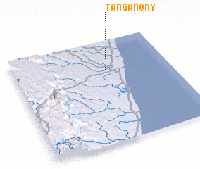 Places with similar names to Tanganony, Madagascar ::
// Danganan (PH)
// Danganon (PH)
// Dinganen (PH)
// Tongonina (CU)
// Tînganu Nou (RO)
// Tangainony (MG)
// Duncanon (US)
// Dungannon (US)
// Dungannon (US)
// Duncannon (US)
Disclaimer :: Information on this page comes without warranty of any kind |
||
|
Where is Tanganony? Elevation and coordinates ::
Latitude (lat): 23°17'0"S Longitude (lon): 47°36'0"E
Elevation (approx.): 15m (map arrows pan, magnifying glasses zoom) |
||
|
Visiting Tanganony? Hotel/Accommodation ::
Book a hotel in Tanganony Travel Guide ::
Buy a travel guide for Madagascar rental cars ::
car rental offers GPS waypoint ::
download a GPX waypoint (PoI) of Tanganony for your GPS receiver
|
||