|
search place name
|
||
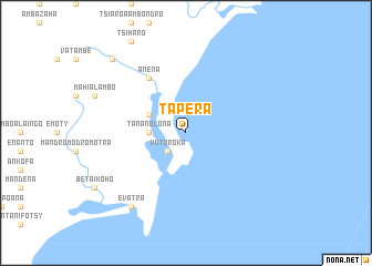
Tapera (Toliara, Madagascar)Tapera is a town in the Toliara region of Madagascar. An overview map of the region around Tapera is displayed below.
regional and 3d topo map of Tapera, Madagascar ::
Tapera airports ::
The nearest airport is FTU - Tolagnaro, located 23.5 km south west of Tapera.
Nearby towns ::
Vatoroka (2.5km south west) //
Tananolona (3.4km west) //
Marokoky (3.8km north west) //
Anena (6.5km north west) //
Evatra (9.0km south west) //
Anena (9.0km south west) //
Ambarinampy (9.0km south west) //
Belavenoka (10.0km north west) //
[all distances 'as the bird flies' and approximate] 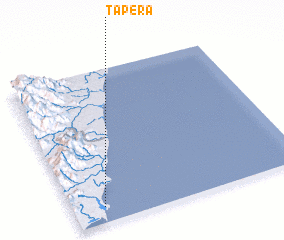 Places with similar names to Tapera, Madagascar ::
Disclaimer :: Information on this page comes without warranty of any kind |
||
|
Where is Tapera? Elevation and coordinates ::
Latitude (lat): 24°54'0"S Longitude (lon): 47°8'0"E
Elevation (approx.): -32768m (map arrows pan, magnifying glasses zoom) |
||
|
Visiting Tapera? Hotel/Accommodation ::
Book a hotel in Tapera Travel Guide ::
Buy a travel guide for Madagascar rental cars ::
car rental offers GPS waypoint ::
download a GPX waypoint (PoI) of Tapera for your GPS receiver
|
||